Showing posts with label Ordnance Survey. Show all posts

Wednesday, October 26, 2022

More Hall Reservoir and Broomhead Reservoir

I caught the Stocksbridge bus from Sheffield and got off just to the north of Wharncliffe Side. I walked down the access road to More Hall Reservoir and then continued to Broomhouse Reservoir, returning along the southern shores back to the bus stop, having to re-trace my steps for the last half a mile or so. The walking was fairly easy going, tarmacked roads, gravel tracks, and well-defined paths through woodland - so I didn't have any problem with my knee.

I  love the small crenellated buildings on both dam walls...I don't really know what their purpose is though.


Despite the recent rainfall the water levels are still very low.


When I reached the dam wall at Broomhead Reservoir the lighting conditions had improved.


One specific thing I noticed today; I passed three public footpaths that weren't shown on my Ordnance Survey map.

Wednesday, April 10, 2019

Replacement Map

I mentioned on a post last week about a hole in my map and how I was disappointed with the general deterioration of the map since I bought it in December. I then contacted Ordnance Survey via Twitter and after exchanging a few messages they have agreed to replace it. I've just finished taping up the envelope that I've placed the damaged map inside to send back to them as requested. So...an unexpected positive result for a bit of effort.

Thursday, September 14, 2017

Preparing For A Walk

Because I usually leave the house quite early to get to the railway station on time I need to do most of my preparations for the walk the day before.

My usual procedure:

Using online mapping I choose my walk. If it's not in an area which is covered by my Ordnance Survey maps I'll then need to print off a copy.

As late as I'm able to do I check the weather forecast. This is usually by watching the weather forecast on TV or going to a suitable website. I don't have an internet capable mobile phone and so rely on my desktop computer; I usually don't have time to boot it up on the morning of a walk though.

If I can use my maps I need to fold them to the correct configuration; not as easy as it might seem...I've actually pulled a muscle doing this.

Prepare my sandwiches, although quite often, especially when it's a last minute decision to go walking, I will buy sandwiches, or sausage rolls, or maybe a pork pie, from the shop.

Fill up my water bottles - it's never water though; usually still orange or diet cola of some description; on cold winter days I might take some soup or rice pudding in my flask. Yet again, sometimes I might need to buy something from the shop.

Check that I know the departure times of the buses; timetables I've printed off the internet...or just written the times on a piece of paper.

Selected my boots: I have different pairs for walking in the Dark Park and the White Peak areas of the Peak District. I wear some older boots when going on local walks...I have a few pairs which I refuse to throw away.

Make sure everything is already packed in my rucksack.

Check that my camera and mobile phone are fully charged.

Have my coat or fleece hung up with what I require already placed in the pockets.

Have my tablets ready for swallowing first thing in the morning, and check that my metformin tablets for my diabetes [which I need to take with food] are tucked into my wallet. Apart from the metformin I also take vitamin D tablets, anti-diarrhoea tablets [just precautionary these days...this used to be a real problem before my diagnosis of severe vitamin D deficiency] and ranitidine as a precautionary measure against acid reflux...this too is much less of a problem since my diagnosis, and subsequently losing over six stones in weight. Sometimes I also take a multivitamin tablet and a tablet for my hayfever.

So...everything else being fine I'm ready to set off for my walk. Of course there are still many things that can go wrong, and have done so.


Sunday, September 11, 2016

Kinder Edge With Chris

Well today I might have been to somewhere that doesn't actually exist...or to a place where I've made up the name. I've always known the edge which marks the northern extremity of the Kinder Plateau as 'Kinder Edge,' yet there seem to be no references to this term online; additionally Ordnance Survey maps just call it 'The Edge.'

I managed to arrive at Sheffield Bus Station in time to catch the Fox House bus and meet Chris for ten o'clock, this being despite there being no trains again...and the bus I had to travel to Sheffield on having an oil leak.

I normally arrive in Sheffield by train and am able to use the toilets on the platform for free, this isn't the case at the bus station though. It costs 20p to go, but it cost me 40p this morning because my money got stuck in the mechanism and the electrics inside the turnstile had to re-boot, hanging on to my first 20p in the process.

Chris was waiting for me when the bus reached Fox House; I got off and we immediately drove to the start of the walk at the Birchen Clough parking area on the Snake Pass.

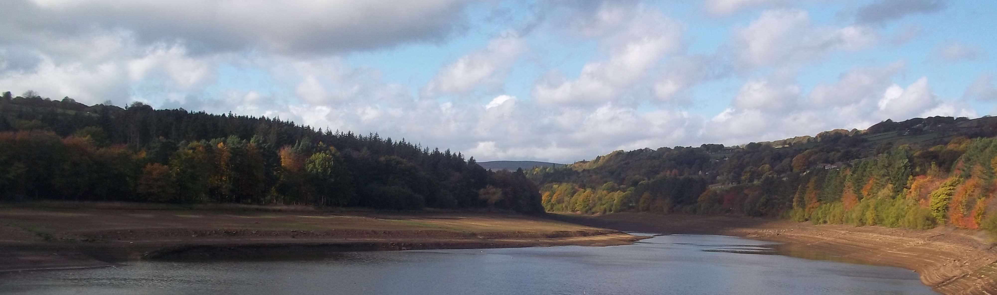
After Chris had got ready we crossed the road and walked over to the Snake Woodlands, turning south and walking along the bottom of the valley, then gradually climbing up to open moorland on Ashop Moor. There are some lovely views of Kinder Edge from here.


We reached Ashop Head and then climbed up on to the plateau from where there are extensive views of Manchester and beyond. I'm not exactly sure of the geography but I'm claiming to have identified Pendle Hill, the Clywdian Range, and Snowdonia.


There were some interesting rock formations to look at as we walked along the edge, we had a bit of fun naming them since they aren't named on the map. When we approached the location where the next photograph was taken we decided we'd better to be very quiet and give the sleeping stegosaurus a wide berth.


More rocks and nice views.


We made our way back down to the car via Fairbrook Clough, another name which doesn't appear on the map. This is difficult descent, Chris said it was as difficult as anything he'd encountered in the Lake District.

I was struggling; I had two severe attacks of cramp, the worst I've ever had...I needed to swallow a couple of extra vitamin D tablets. When I see the nurse on Tuesday I will have to mention this to her.

We arrived down at the Snake Pass road at a very pretty spot.


At this point we made a decision; because my walking pace had significantly slowed we decided that Chris would return to the car and pick me up at the Snake Inn...which I noticed is now called the 'The Snake Pass Inn.' This saved my legs over half a mile.

I was dropped off at Malin Bridge where I caught the tram back to Sheffield City Centre. When I arrived at the railway station there were still no trains running to Doncaster.  I had to walk to the bus station and catch a rail replacement coach. There were some railway staff there and so I complained because there was no advanced information about the line closure on either the Northern Rail webpage or the SYPTE site, where I thought such details would be updated. I was told that all the details had been posted on an obscure railway engineering website six months ago; I told the man that I wasn't interested in railways...I just wanted to get home. He then got on his high horse and told me that I was the first person to complain today, well boo hoo; what did he expect me to do, give him a slice of cake, or kiss him?

That's the bloody trouble with people today, no-one complains, no-one wants any confrontation in our over polite, politically correct world inhabited by special snowflakes.

As I was sitting on the bus waiting for it to set off for Doncaster several people wanted to get on without first having purchased tickets, this is actually allowed on some trains; the guard will sell you a ticket. So...a massive heated argument flared up between the driver and about three or four women who hadn't got tickets. They were told to wait until a member of staff working for the appropriate train operating company arrived with his or her ticket machine. They weren't happy; I'm not sure if they got on the bus or not. To be honest I was with the woman, if a train company doesn't provide a service you shouldn't be expected to pay for that non-existent service, quite a radical and shocking idea...send for the thought police to kick down my door and taser me.

Long live the revolution!

Sunday, September 20, 2015

Where Has Chesterfield Gone?

Something that I've noticed and thought I'd post on the blog.


This is a screenshot of what happens at a certain magnification when I'm using Ordnance Survey maps. Where is Chesterfield?

Wednesday, September 2, 2015

My Maps

I sometimes mention my Ordnance Survey maps in my blog reports; I have three that I use for my walking, the 1:25,000 scale Explorer series sheets covering both the Dark Peak and the White Peak, and the 1:50,000 scale Landranger series covering Sheffield and Doncaster.

The mapping and quality of printing on the Explorer sheets is excellent, clearly showing detailed features such as field boundaries, pylons and overhead power lines, types of terrain, and even individual rock formations...all of which really help me to navigate. The only criticism that I have to make concerns the coverage areas; because the point where the two sheets join is the Hope Valley, right in the middle of the area of the Peak District easily reachable from Sheffield, I regularly end up having to place both sheets in my map case.

My other map, covering the local area where I live in Doncaster obviously isn't as detailed...but this isn't a popular tourist and outdoor pursuits area. Of course I can get 1:25,000 mapping with text and features as large as I like online, and then just print off a personalised sheet.

Another online service that I frequently use is Google Maps or Google Earth, for the public transport information, the location of bus stops and the services which stop there.


Wednesday, April 10, 2013

Bolsover Castle And Sutton Scarsdale Hall.

Today I visited two English Heritage properties located in a part of Derbyshire I haven't visited before; Bolsover Castle and Sutton Scarsdale Hall.

I don't have an Ordnance Survey map covering the area, so I downloaded one from the internet; as well as a bus timetable and a route guide for a circular walk from the castle to the hall, and back.

There was a spectacular view of the castle as the bus entered Bolsover: I was really looking forward to this visit after reading so many positive reviews online. I arrived about twenty minutes before the castle opened to the public and so I had a quick look around the town. Bolsover is a very pleasant, small market town; most of its buildings are made of the same type of sandstone as the castle, and there are several quaint pedestrianised streets and courtyards. I popped into a shop to buy a sandwich and a chocolate truffle bun. This was the heaviest bun I have ever held in my hand; it must have weighed the same as a small cannonball - it was delicious though. 

According the the location maps that I found there are meant to be four lots of public toilets in the town centre - I couldn't find any of them and had to wait for a pee until I reached the castle.

Bolsover Castle isn't a typical mediaeval ruined castle; it dates from the seventeenth century and was more of a stately home than a castle...there was an older fortified castle on the site though.

Here's a link to the castle's Wikipedia page:  http://en.wikipedia.org/wiki/Bolsover_Castle

Here are some photographs I took.


I spent nearly two hours walking around the castle. The audio commentary was very interesting and lively, and there's a bit of clever technology used which synchronises your commentary to the images being projected onto the wall in one of the rooms; the beer cellar.

With the map and the written instructions in hand I then set off for Sutton Scarsdale Hall, which I had spotted from the castle's battlements. It's about three miles away, but because of the imprecise and confusing directions, and old map which didn't depict the new bypass and an industrial estate, I walked considerably further.

The walk isn't particularly attractive, mainly across fields and down country lanes and farm tracks. By the time I got there the hazy sun which was attempting to break through the clouds as I was exploring the castle was nowhere to be seen. It was quite murky now, and a few degrees colder.

At one time Sutton Scarsdale Hall would have been very impressive, but it's only a shell now. It's quite a sad story how this happened.


I didn't stay very long; there wasn't that much to see, and there was a funeral being held in the church, right next to the ruins.

The walk back to Bolsover was much quicker since I didn't get lost - there were a couple of recently ploughed fields to cross though. It's always annoying, and hard work, when the farmer doesn't drive his tractor along the alignment of the footpath so that walkers are able to use the tyre tracks.

I arrived back at Bolsover thinking that I'd only have a few minutes to wait for the bus. I checked the timetable just in case though, and was glad that I did; the Sheffield to Mansfield service only runs every two hours - many small villages in the Peak District have a much better service than this.


Wednesday, March 13, 2013

Matlock, Wensley, Warrencarr, Stanton Lees, Stanton Woodhouse, and Rowsley.

The day started with me knocking over a display of leaflets in the café in the town centre where I usually have a cooked breakfast when I'm walking mid-week, prior to leaving for the railway station to catch the train to Sheffield. If I'm going to have an accident when out on a day's walk, a café is as good a place as anywhere I suppose.

When I reached Matlock I got off the bus at Hall Leys Park to visit the toilets. There are some more public toilets only a couple of hundred yards away at the railway station, but by starting my walk here I was able to take this photo of the fountain.


I walked over the bridge, up the steep road at the side of the station, and through the gate which marks the start of the Limestone Way: it could be better signposted, but it's an impressive sight which greets your eyes - beautiful limestone grassland. The first few yards are quite steep; but you can always stop for a rest and turn around to enjoy the impressive views of the town.


I continued along the Limestone Way for about a mile, all the while the views of the Derwent Valley were opening up as I steadily climbed. I then took the track which leads down to a road, not too much a loss of altitude though...and then continued along the tarmac for about fifteen minutes until I reached the next path, heading in a northerly direction across fields.

At this location I was quite high up and there was still some snow about, and this snowdrift near to a stile looked to be quite deep.


Fortunately I didn't get to find out how deep, because the snow was still frozen so my boots only sank in a couple of inches. It did present me with the opportunity to take an unusual self-portrait though.

The views of the Derwent Valley were still lovely as I approached, then descended into, Wensley Dale; spelled using two words in Derbyshire...unlike the  valley in Yorkshire.

There was then a short climb up a track into the village, where I observed that nearly a quarter of the properties were for sale or to let.

The climb out of Wensley and then the descent into Cambridge Wood were easy enough. Later, as I approached the Enthoven factory/mill I noticed some substantial ruins of an old mine engine house. Like the locations of several other industrial relics in the Peak District it isn't depicted on the Ordnance Survey map.


The hamlet of Warrencarr was next, and then I took the road up the hill to Stanton Lees, followed by a path, but probably not an official public footpath; because, even at this time of year it was very overgrown with moss and rhododendrons ..and a lot of fallen branches, and debris from small landslips.

Today's final photograph is of Stanton Woodhouse, which I captured with the sunlight at just the right angle.


I arrived at Rowsley with a few minutes to spare; the bus arrived about five minutes early though. Maybe the driver thought it was a Sunday, when it should be at Rowsley at that time.

When we got to Baslow Nether End we thought the driver might be confused again. He drove around the green as though he were going to Chesterfield and one of the other passengers sought re-assurance that he was indeed going to Sheffield.

The reason for using the other bus-stop was that two delivery vans were blocking the normal access route: so the bus had to reverse and then continue as normal to Sheffield.

Monday, January 23, 2012

Darley Dale, Darley Bridge, Crossgreen, Bonsall and Matlock Bath.

I got off the bus just south of the parade of shops at Darley Dale, walked a few yards down the road and then took the footpath across fields which leads towards Darley Bridge, using a short stretch of road which has a bridge which crosses over the Peak Rail railway line.

I walked through the village today, right to the church at the top of the hill. From here I followed the road which cuts back towards the hamlet of Crossgreen; which is printed as one word on the Ordnance Survey map, but I'm sure was two separate words when I saw the sign at the entrance to the settlement.

The next section of the walk was probably the highlight of the day, with some lovely countryside and pretty much perfect weather conditions for both walking and photography.


The route first cuts across fields and then climbs a shallow valley which runs to the south of Wensley; then steadily climbs up over undulating fields and grassland. I took several opportunities to stop and admire the views northwards behind me of the Derwent Valley, Chatsworth House and the distant moors. On the map this mile and a half of walking looks as though it might be quite boring; but, believe me, it isn't.

It was then a steady downhill walk to Bonsall, the last few hundred yards being along a country road, where at a junction someone had been having a bit of fun with the road signs...but certainly not helping anyone who might be lost. I've never been to Luton myself.


Bonsall is a pretty linear village with some impressive stone buildings and a historic cross in its former Market Place: I didn't take any photographs though because there were a couple of delivery vans spoiling the views.

For the next section I climbed a small hill, skirted a quarry and dropped down into Matlock Bath; Derbyshire's own 'seaside resort' - even though its probably sixty miles from the coast.


It's quite commercialised, with several fish and chip shops, cafés, pubs, amusement arcades and gift shops. In high season, or on a weekend in the winter it can get very busy, especially on Sundays and Bank Holidays when dozens of bikers will turn up with their motorcycles and park them along the Promenade for everyone to admire. It was nearly deserted today, with most establishments closed; maybe they were much busier yesterday.

Wednesday, December 14, 2011

Calton Lees, Beeley Hilltop, Robin Hood and Baslow.

I glimpsed my first snow of the winter today: as I was sitting on the bus travelling across the moors towards Fox House the sunlight was illuminating the remnants of last week's snowfall on the higher ground of Kinder Scout and the Great Ridge. There was, however, no snow underfoot where I was walking today; it was just a bit frosty and icy.

I got off the bus just beyond Calton Lees and walked up the lane to Beeley Hilltop. The sun was at just the right angle to light up the countryside and cast dramatic shadows in the direction of Chatsworth Park. This photograph was taken looking towards Edensor Church.


Not far beyond Beeley Hilltop the lane deteriorates and becomes nothing more than a bridleway. After about a mile I reached the boundary of access land and walked across Beeley Moor towards Hob Hurst's House. The site is very disappointing, but the information board explains everything.


It was then a steady descent along the western fringe of Gibbet Moor. The Chesterfield road soon came into view and I noticed a footpath sign. When I was close enough to read it, it was going in the direction of Robin Hood. The footpath wasn't marked on the map, but it was well established and so I decided to follow it.

I was aware that there was quite a substantial beck at the bottom of the valley, just below and before the road. No footbridge or even stepping stones were indicated, but I wasn't concerned because these features quite often don't appear on Ordnance Survey maps.

When the path reached the beck it continued following the bank, becoming quite overgrown in places. It wasn't long until I could see the Robin Hood Inn, just a few yards away; but I couldn't reach it because a deep ditch, a fast flowing beck, a tall drystone wall with what looked to be barbed wire on top...and a road, were all in the way.

I had planned to continue beyond Robin Hood and visit Nelson's Monument and the Three Ships rocks on Birchen Edge and eventually finishing the walk at Calver. Obviously I needed to change my plan; the weather had become cloudy by now and a few degrees colder than when I set off, and so I decided to continue towards the northern perimeter of Chatsworth Park and then catch the bus at Baslow Nether End.

Wednesday, November 23, 2011

Miller's Dale, Wheston and Bradwell.

Due to a change in my regular weekly schedule I was able to fit in an extra walk today. Although still not fully recuperated from Sunday's walk I decided to take advantage of the good weather forecast, even though the day turned out to be far more hazy than I'd hoped for. It was mild and dry though, and neither foggy nor windy, so it was okay.

The walk started at Miller's Dale, this time climbing up the other side of the valley than I'd done a couple of weeks ago. It was less steep, not as slippery, and not as high either, so I only needed to stop a couple of times for breath. Underfoot it was good walking, due to this being a bridleway and a section of the Limestone Way.

Once I'd reached high ground I was progressing quickly, well aware of the fact that it would be dark by four o'clock and I had over eight miles to cover. It was an almost straight, level track for the next mile and a half to Wheston, with only a short stretch of country lane. Just before I reached the village it seemed to be the brightest part of the day; I turned round to admire the view behind me and noticed these trees which seemed to look rather threatening, as though they were attempting to reach out and grab me.


The next section was entirely along a country lane, but I made good time to Mount Pleasant Farm on the main Chesterfield to Stockport road. Just beyond the farm I could look down into Peak Forest, which appeared to be much larger than it's depicted on the Ordnance Survey map. At this point I also noticed a strange feature on a distant hill; it looked like a gaping hole. I got my binoculars out, and indeed that's what is was. Just before writing this post I checked online, and it's known as Eldon Hole, a deep cavern with many interesting tales about it. It seems only experienced cavers are able to explore it though.

A few minutes later I turned right onto the path that leads to Bradwell, across an area of old spoil heaps: not an unpleasant area to look at though. By now I was looking at my watch and wondering if I'd arrive in time to get some fish and chips. It was too late though when I got to Bradwell, the chip shop had been closed for over ninety minutes; it seems to have rather limited opening times.

I was hungry though, and so went into one of the shops and bought some sausage roles and jam tarts which they were selling cheap. It was a bit of a wait for the bus, and so I sat on a bench and enjoyed my food; attracting a few strange glances no doubt.

The bus arrived about ten minutes late and so I thought I'd miss the express train at Sheffield. It was late too...so I was able to catch it.

Sunday, November 20, 2011

Moscar Moor to Hathersage.

Most of today's walk was done in thick mist, apart from the highest point of the walk at the northernmost end of Stanage Edge and the last mile walking into Hathersage.

I got off the bus at the county boundary on Moscar Moor and headed towards Stanage Edge. Instead of walking along the top of the Edge as I did the last time I was here, I decided to take the path which leads along the bottom of the cliff and then across the moor.

After stopping to eat my sandwiches in the sunshine I descended onto what the Ordnance Survey map identifies as 'Moscar Moor' but I've always known as 'Hathersage Moor.'  It wasn't long until the mist enveloped me, but the path was well defined and I made good progress. However, the line of the path soon became indistinct, and since I couldn't see any identifiable landmarks I had to start using my compass and head due south to where I knew the road was. The heather had  recently been burned back and so it was easy to just walk in a straight line with few deviations.

After about twenty minutes I could make out some trees ahead of me and a few yards closer I could see parked cars; I had arrived at the parking area at Dennis Knoll. I had to climb over a fence to get to the track which leads to the road though; obviously I hadn't come off the moor at the point where the footpath does.

The next stretch was a gentle descent to Green's House where I passed through a gate on wheels which was very easy to open, unlike last week when an unhinged gate fell on me.

By now the mist was clearing and so I took a few photographs. This one shows  the location of  Brontë Cottage, so named because of the Jane Eyre connexion with the area.


It was then a very pleasant walk into Hathersage with the sun getting stronger all the time.


Sunday, October 23, 2011

Fox House, Totley Moor, Longshaw Estate and Back to Fox House.


My first circular walk. At Fox House I walked a few hundred yards back along the road towards Sheffield and then took the footpath which leads in an easterly direction across Totley Moor. It was easy going, being fairly flat and a well-defined path.

It wasn't long until I had distant views of the western suburbs of Sheffield, unfortunately spoiled today by the hazy weather conditions. I stayed on high ground and looped back across the moor taking a more southerly route, heading for what looked like a rather impressive cairn. When I reached it though it was something I haven't come across before, a combination of cairn, grouse butt and shelter; marked as an enclosure on the Ordnance Survey map when I checked.


A few minutes later I stopped to eat my sandwiches near to the remains of a drystone wall and noticed a strange insect which looked like an elongated beetle - it was an inch and a half long. I've never seen anything like it before and wonder if anyone can identify it?


I then passed near to the trig point on Totley Moor and about a mile later reached Lady's Cross; which is rather disappointing.

It was then a short walk over to Longshaw Lodge where I was hoping to stop awhile for a pot of tea and a bit of something to eat, but the place was too busy...I would have missed my bus. I stopped for a while though and sat on a conveniently situated millstone to admire the view of Higger Tor and Carl Wark; and to look forward to my stew which would be simmering in my slow cooker at home.

Just out of curiosity I looked through the windows of the pub at Fox House, and it was very busy in there too.

Tuesday, February 8, 2011

Pilsley, Hassop, Bubnell and Baslow

I got off the Bakewell bus about a mile south of Baslow and soon found the path going up the hill and over the fields to Pilsley, one of the pretty nineteenth century                 Chatsworth Estate villages.

I walked through the village and after a few hundred yards came to a footpath which led across meadows back to the Bakewell road, and then through a wooded valley to Hassop.


There's a very impressive hall in Hassop which I've noticed when passing on the bus, but today was the first time I'd actually visited the village, as it was the case with Pilsley...and Bubnell later on.

The next part of the route was walking along the ridge above Bank Wood; at times the views were quite restricted - which wasn't really a problem since there was a large quarry on the other side of the valley which isn't shown on my Ordnance Survey map.

I had intended continuing to Calver and then walking along the Derwent Valley Heritage Trail back to Baslow but the descent down into Calver looked quite steep, and I had a twinge in my right knee. The path across open fields down to Bubnell seemed the safer option.

I soon arrived at Bubnell, then crossed over the river to Baslow, where I didn't have too long to wait for the bus.