Sunday, March 29, 2020

Google Street View Virtual Walk: Tissington to Wirksworth


This is the walk I should have been doing today.


On Sundays the X71 bus timetable would have had an additional service going to Carsington Water, and this route would be serving Tissington...well, Tissington Gates actually, half a mile to the southwest of the village. Often cited as being the most beautiful village in the Peak District and I was keen to go there - of course because of the coronavirus I'm only able to visit using Street View images.

It's a lovely approach to Tissington from the bus stop and once I'd arrived there there would have been plenty of pretty cottages for me photograph, plus the church, the old schoolroom, and the duckpond. I think there are two tearooms and I would most likely have been a customer at one of them.

I really enjoyed my virtual tour of Tissington; I completely lost track of time - which is exactly what I need to be doing when I'm stuck at home in lockdown. I was limited to what I could see on my screen  though, some images were distorted, cars were in the way, and some parts of the village weren't covered.


The countryside to the east of Tissingtom looks a bit like Chatsworth Park, maybe a little less hilly though.


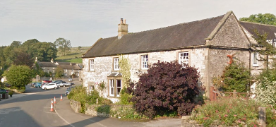
The next village I  would have reached is Bradbourne; there's a pretty church there I would have been photographing. It's set back from the road though and so I couldn't see it when I went by using Street View.

I would have had to walk along the road to Netherton Hall but then there's a footpath for most of the way to Carsington.

Hopton is only half a mile from Carsington.

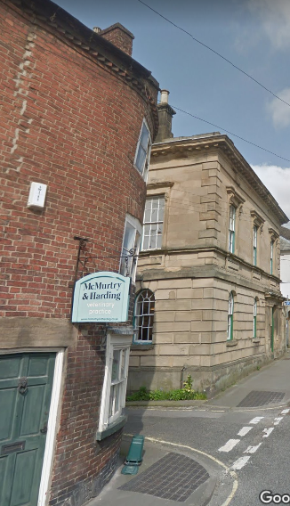
At Sycamore Farm there's path that goes across the fields to Wirksworth. I would have caught the first available bus going to Bakewell and then  another bus from there to Sheffield and so wouldn't have been wandering through the alleyways and courtyards of the town as I've  attempted to do virtually.


Thursday, March 26, 2020

A Walk In The Park...And Then A Bit Further

I haven't received a letter or text message from the government stating that I'm a vulnerable person; I'm thinking it's because diabetics are no longer included on the list of groups of people who need to be shielded from the virus and have to stay indoors for twelve weeks.

I'm very relieved about this and so decided to leave the house for the first time since the weekend early this morning  and went for a short walk, passing through my local park to reach a large area of playing fields known as Town Fields. It was six o'clock and there weren't many people around at all, just a few joggers and dog walkers.

Obviously I took my camera with me; it was a glorious start to the day.


Interestingly Town Fields is the location where George Boole first thought of the ideas which would lead to the concept of Boolean algebra, or logic, no more than an entertaining parlour game to play with his friends at the time, but now a key component in computing and electrical switching and circuitry utilised by us all on a daily basis every time we type a query into a search engine.


Wednesday, March 25, 2020

Unpacking My Rucksack

I've just completed a short, but sad walking related task at home; I've been unpacking my rucksack - I won't be using it for quite a while.

My anorak, hi-vis tabard and overtrousers have been hung up on the rail upstairs, the spare pair of socks thrown into the laundry basket, my first aid kit plus the knee and ankle strapping have gone to the kitchen cupboard, my headtorch is now on the shelf at the top of the stairs leading down into the cellar...and the emergency stash of flapjacks and chocolate that I always carry with me will soon be eaten. My compass, whistle and ice grippers can stay where they are.

It's been a ritual that I felt I had to perform; an acknowledge that I won't be able to go walking in the Peak District for a long time, and that the world will never be the same again. It's also given me an opportunity to reminisce about better times and take comfort in the fact that I'm well prepared for this emergency...however long it lasts.


Tuesday, March 24, 2020

Google Street View Virtual Walk: Hulme End, Warslow, and Upper Elkstone

The second of my virtual walks using Google Street View to visit the areas of the Peak District I would have been travelling to using the X71 bus service from Sheffield - I've got to do something to keep me occupied during lockdown.

Today's starting point is Hulme End, just over the county boundary from Hartington, from where I started yesterday's virtual walk. The bus would have dropped me off at the Manifold Visitor Centre, which is housed in the old booking office at the former railway station of the Leek and Manifold Valley Light Railway.

This was the only angle I could get from Street View; there seems to be a bit of a break in coverage here.


I would have needed to walk along the road for a bit before I reached my first footpath going towards Warslow; it finishes a few hundred yards short of the village and so I would have had to continue down the road.  I could only compose the one image from the village - I couldn't find any pretty cottages or a rustic pub.


I would have taken the southernmost of two footpaths going across to Upper Elkstone, which is nothing more than a hamlet really.

Climbing up to a location known as Herbage, I would have been heading back north; I think there might have been some nice views to enjoy from up there - it looks like the landscape is very similar to areas of the Eastern Moors that I am very familiar with. 


The path continues to the north, now going downhill. Lum Edge is over to the right and by looking at the map it seems to be rather insignificant compared to the Eastern Edges which I know so well.

My planned route then veered to the east, and then southeast, returning to Hulme End.....it would have been nice if there were to be time for me to visit the rather attractive pub a few hundred yards to the east of the bus stop, right on the county boundary.


Monday, March 23, 2020

Google Street View Virtual Walk: Hartington to Alstonefield

I'm self-isolating because of the coronavirus outbreak and so won't be able to go walking for several months I should think. This coming weekend a new bus service was due to start going from Sheffield to Alton Towers and passing through many parts of the Peak District that I'd not been previously able to reach. I'd been very excited about this and had been researching the places I'd be going and planning the routes I'd be walking in quite a bit of detail using Ordnance Survey Maps and Google Street View. I've already made extensive notes and so I thought I might as well make use of these to write up virtual walks using images from Street View that I've cropped to my liking.

The first place that I'd planned to travel to on the bus would have been Hartington. I've only visited the village once, that was with my friend Chris from Leeds - we didn't stay there very long because we were in a hurry to get back to the car.

So...I'll start by exploring Hartington using Street View.


I then planned to head south, going across the fields and then down into the upper reaches of Beresford Dale where I would have spent quite a bit of time taking photographs if the weather was good. I'd only be walking for about half a mile in the dale though before taking a track and the a footpath which leads through the gap between Narrowdale and Gratton Hill.

It would then have been only a few hundred yards until I arrived at Alstonefield, a pretty village across the county boundary in Staffordshire.


I've enjoyed writing this virtual walk and hope people enjoy reading it too; it's obviously not the real thing, but it's the best I'll be able to manage until at least quite late into the summer. I will continue regularly updating with all of the other walks I've planned and look forward to the next time I can set foot in the Peak District.


Sunday, March 22, 2020

Self-Isolation

I've decided to self-isolate for the foreseeable future, the only times I'll be leaving the house will be on a Thursady when I'll go to the shops with my support worker...and maybe go for a short drive to some quiet spot in the country for a short walk.

I think I'll be classed as being in one of the vulnerable groups of people who need to do this, I've got diabetes and acid reflux oesophagitis. Although my diabetes is well managed the medical profession doesn't yet know how my tablets might affect me if I get infected...and occasionally I get a coughing bout when my acid reflux flares up...not something I want happening when I'm out in public.

So...I won't be doing any serious walking, probably for at least three months - the furthest I'll be going is from my front door to the bottom of my garden, or from the far corner of my cellar up to the attic.

I'm going to try and keep the blog active, maybe with updates from my garden or musing on various walking or mapreading based themes.


Friday, March 20, 2020

New X71 Bus Service Suspended

I've just been looking at the Hulley's of Baslow Facebook page and as I was expecting, they have suspended the new service going to Alton Towers. Since Alton Towers will be closed because of the coronavirus outbreak, and we'll all probably be under lockdown or worse by then it hasn't come as a surprise.

I doubt I'll be seeing the Peak District again this year.

Lodge Moor And Some Of The Leafy Suburbs Of Sheffield

I limited the scope of today's walk to staying well within the boundary of the City of Sheffield just in case there might have been problems with the buses coming back from Derbyshire caused by a tightening of the coronavirs restrictions. I travelled to Lodge Moor and walked back to Whirlow Bridge - from where there should be plenty of buses going  to the city centre, but just in case they weren't running I knew that I could easily walk down the hill for a few miles to the railway station. 

From the bus terminus at Lodge Moor I walked along the road to the Sportsman pub and took the path that skirts the playing field, heading south, then east, and south again until I reached the road. Bennet Grange was the next place marked on the map,  I continued along the road until I reached the path going down the Porter Valley.


I passed Forge Dam Cafe, only using the public toilets there before turning to the south and heading uphill to reach Cottage Lane, and then Ringinglow Road and a footpath that passes close to Whirlow Hall Farm. 

When I reached Hathersage Road I waited a few minutes just to check that the buses were still running and then decided to start the second part of the walk, which would take me to Abbeydale.

It's a pleasant walk alongside the edge of more playing fields on the approach to Ecclesall Woods. I had to check exactly where I'd come out on Abbeydale Road South but it wasn't really necessary because wherever I was I needed to go south towards Dore and Totley railway station and my nearest access to the parkland surrounding Beauchief Abbey beyond.

This sign was at the side of the road right next to the golf course; I'm not sure if it applies to the golfers getting ready to swing their clubs out on the fairways.


There were long periods of sunshine today - but not when I was photographing Beauchief Abbey.


I was feeling good, the weather was fine, and I had plenty of time and so I extended the walk pressing on to the east, to Chancet Wood and Graves Park. I bought one of the large dark chocolate and white chocolate cookies at the Rose Garden Cafe in Graves Park, and sat outside in the lovely, sheltered rose garden seating area.


The next section of the walk, heading north to Gleadless Valley Country Park was still quite rural in nature despite only being less than two miles from the city centre when I finally hit the densely populated urban area...I noticed on the map that I went to within about half a mile of Bishop's House in Meersbrook Park, somewhere I've been meaning to visit on one of my walks for quite a while.


I got completely lost in the Heeley area and so when I reached a bus stop that showed that a bus going to the city centre was due I waited and boarded it.

I bought some food items in the market and took a few one-handed photographs as I walked through the city centre to the railway station - I had a shopping bag in my other hand.


When I got to the railway station I could tell that there were noticeably fewer trains running - I had to wait half an hour for one going to Doncaster. On the train there was an announcement that the checking of tickets has been suspended due to the government's social distancing guidelines. There was plenty of social distancing in operation in my carriage...it was nearly empty.