Friday, January 28, 2022

Climbing Mam Tor

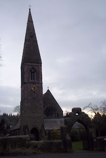
I managed to do my planned walk today from Bamford even though my expected bus didn't show up. I had to catch the 257 ten minutes later; it goes by a different route. I got off near to the church and then walked down to the mill.


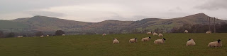
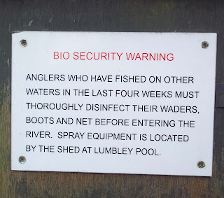
I used the stepping stones and the walkway to cross over the River Derwent and then continued across the fields to Hope. En route I passed by a sheep in a field all on its own, just standing there without moving at all. I've not seen that behaviour before.

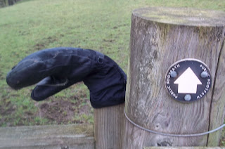
So many times I see an odd glove left on a gatepost when someone will have removed it to open the latch and have then dropped it. The next person to come along must pick it up and place it on the top of the gatepost - it must be basic walking etiquette.


I kept to the north of Hope, missing out most of the village.


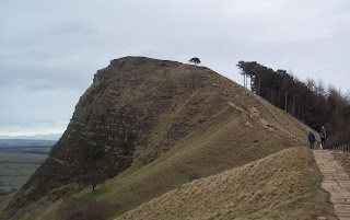
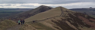
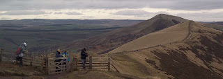
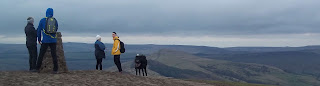
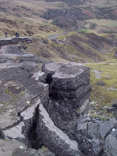
From Hope I looped my way over to Castleton, climbing part of the way up the southern flank of Lose Hill to Losehill Hall Farm and then taking a lower level path heading towards, Hollins Cross, the lowest point on the Great Ridge. 


I continued along the ridge until I reached Mam Tor, the highest point. It was very windy up there, the windiest I've ever experienced it in the Peak District.


Part of my route to Castleton took me down the abandoned road.


At the Odin Mine Crushing Circle I found another item of abandoned clothing...these boots.


Something else abandoned a bit further on.


On the approach to Castleton I spotted this weathered carving of a hand holding a hammer.


I should have had only twenty minutes to wait for the bus...but it was ten minutes late.

Monday, January 24, 2022

Photographing The Water Troughs On Stanage Edge

I travelled to Cutthroat Bridge, the bus stop before the Ladybower Inn, and walked up onto the moors, taking the route I'd use to reach Bamford Edge. I turned left and headed east though and soon reached Stanage Edge. It was much mistier than I was expecting and so had to concentrate on taking close up photographs of the rocks and the numbered drinking troughs carved into the rocks for the grouse.


About halfway along the edge I took a track known as 'The Long Causeway' that goes over to Stanedge Pole and then down to the Redmires Reservoirs. 

Notice that I've used the Ordnance Survey spelling of 'Stanedge Pole.'


I don't know if this is a flower or a fungus, or if it's even really something natural. It was down by the water's edge and behind some fencing. I couldn't get any closer than about three yards away.


I continued walking along the road until I reached the car park and the entrance to Wyming Brook Nature Reserve. It was quite a steep descent down the side of the brook to the track at the bottom.


I climbed up through Fox Hagg Local Nature and caught the bus from the terminus near to where the path comes out.

Wednesday, January 19, 2022

Bawtry, Scrooby, Blyth, Hodsock, and Carlton in Lindrick


The Retford bus didn't show up and so I couldn't do my planned walk starting at Sutton Crossroads, so I caught the Worksop bus and travelled to Bawtry.


I took some photographs of the town and then headed off to Scrooby. At one of the first properties in the village there are usually a couple of vintage cars. The sun was at a good angle and so you can make out quite a bit of detail.


I took the track that goes in the direction of Serlby Golf Course and comes out on the road near Blyth.


After spending twenty minutes in Blyth I walked across the fields to Hodsock. As I got my first glimpse of the priory I stopped and looked behind me to see the tower of Blyth Priory Church and enjoyed the moment for a few seconds standing in a place where it's possible to see two priories from the same spot.

I finished at Carlton in Lindrick, it's quite a boring walk along the track from Hodsock.