Showing posts with label New Junction Canal. Show all posts

Saturday, March 14, 2026

Stainforth and Fishlake

The local weather forecast for today was for it to be dry for a few hours in the morning and so I caught the Thorne bus to Stainforth and crossed over the bridge and within a few seconds saw the footpath that goes up onto the embankment and followed the River Don for about a mile to Fishlake. 


When I was looking at Google Streetview last night I noticed that there was an old fighter aircraft being stored in a field next to the village hall; unfortunately it isn't there now. I continued to walk through the village and then along a country lane for a mile or so until I reached a path, which according to my Ordnance Survey map led to a footbridge going over the New Junction Canal. Well, when I got there the bridge had been removed so I had to return to the road, a distance of a few hundred yards. A notice explaining the closure would have been helpful.

At the road there was another footpath going off to the left, heading south back towards Stainforth. After only a few yards my route was blocked again, this time by a barbed wire fence; it was obvious that this was a public footpath, you could see the sign at the side of the road. There were two female walkers approaching me, one of them checked her online app and that clearly showed that we were on the currect path; I decided to squeeze between the gap between the two wires and they managed to get around it by stepping into a drainage ditch.

After a few minutes the path continued along the top of another embankment - there were some decent views to enjoy.


.  


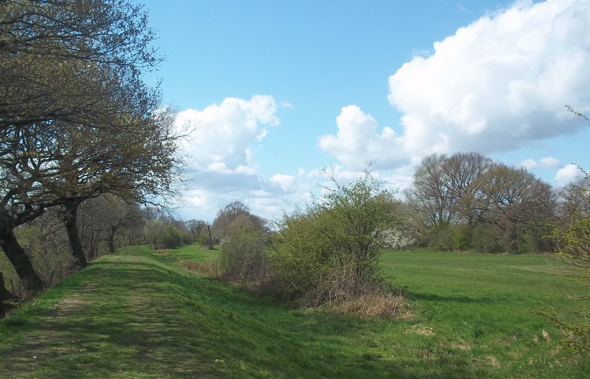
The embankment. and therefore the path, were now going parallel to the road that goes to Stainforth, there were a couple of gates I could have easily climbed over to reach the road, but I didn't. I thought I'd regretted that decision when the path made a sharp left turn because the route straight ahead was blocked by what I'm assuming is a flooded remnant of the old course of the River Don. I'm glad I had to go this way though because I got to pass through a beautiful area right on the western approach to Fishlake...it's shown in the photograph below.


I had a few hundred yards to walk back to the bus stop at Stainforth; fortunately the bus back to Doncaster was waiting there - I dashed to get on and as soon as I took my seat the driver set off.

Saturday, June 26, 2021

Fishlake, Sykehouse, Moss, and Askern

I travelled to Fishlake, explored the part of the village near the church for a few minutes and then headed northwards along a bridleway towards Fosterhouses.  To begin with I took a footpath which starts at the back of the churchyard rather than walking through most of the village.


About half a mile of the bridleway north of Fishlake was completely overgrown with bramble, nettles, and thistles, maybe four foot high in places and very dense. If I hadn't been wearing my thick. heavy hiking trousers I wouldn't have attempted it. As it was my arms and legs were stinging and itching, and still are now...I'm looking forward to soaking in a hot bath in a few minutes.


I then walked over to Sykehouse Lock and crossed over the New Junction Junction Canal and took the middle of the three approximately  parallel footpaths that go to Sykehouse. Walking over to Sykehouse I disturbed a deer and it ran out in front of me, only a few yards away - a bit later the same thing happened with a hare.


After walking through the village and then along the road I found a path which eventually came out on the road, just to the east of Moss.


[The electric fence was protecting me.]


The level crossing at Moss is the most interesting thing to photograph there.


I walked along the road for the rest of the way back to Askern. I arrived just a few seconds before the bus did, it was pure coincidence though.


Saturday, May 29, 2021

Askern, Braithwaite, Kirkhouse Green, and Hawkhouse Green

Today's walk has been a local themed walk featuring trees. I travelled the seven miles to Askern, a placename that's a combination of Old Norse and Old English and means 'house near an ash tree.'

After getting off the bus at the boating lake I  took  the footpath going east, to the south of some houses, and after a mile briefly passed through Alder Wood.


I walked through some lovely wildflower meadows...and there would be more to come.


This horse wasn't being bothered by the flies and the alpacas were just a bit curious.


I continued to Mill Dike Bridge near Trumfleet and then walked along the road, soon passing Willow Bridge Farm and then Willow Bridge.


It wasn't long until I  reached Braithwaite.


I walked along the towpath, heading north; there were several boats on the canal.


After about a mile I took a footpath heading off to the left; I didn't get far though until the path became waterlogged and overgrown. So, I returned to the towpath and then walked along the road to Kirkhouse Green. 

This lorry was just approaching the mobile homes park there.


I continued along the road for a few more minutes before taking a rather overgrown, but passable path to Hawkhouse Green. According to the map there's an 'Ash Hill Farm' there.


There's a Fir Tree Farm at Moss, but I stayed to the south of the village, using back lanes and then the direct road to get back to Askern. 


Friday, April 9, 2021

Sykehouse, Eskholme, Topham, Fosterhouses, Fishlake, and Stainforth

I travelled to Sykehouse today; the bus does go a rather circuitous route and so I made an early start so as not to be setting off too late. After photographing the church I headed east through the village and then took a footpath going north until a junction with another path going east. I was hoping to use this to get to the towpath of the New Junction Canal but the path was closed because of drainage work. I had to walk along the road for a couple of minutes but it was no great inconvenience.


[The notice attached to the gate reads 'Free books in church porch. Please take them.']


I soon reached the Went Aqueduct, it's not as spectacular as the Don Aqueduct further south, but this was the first time I've walked across it - I have been across it on a barge though. Unfortunately there was a sign stating the towpath was closed, and some workmen were there assessing the damage to the bank that had collapsed.. This closure would cause me a lot more inconvenience than the earlier footpath closure - I would have to significantly change the route of today's walk because I wouldn't be able to walk along the towpath of the Aire and Calder Canal. There's a footbridge so I was able to cross the aqueduct on the other side and then walk for a few yards to reach the Aire and Calder Canal. I sat and ate my sandwiches at this location, literally just inside the East Riding of Yorkshire, and planned where to go next.


Obviously, unless I wanted to head off towards Goole and oblivion I would have to head back south, going across the aqueduct again. There's a path, or towpath, at both sides of the canal and so I didn't need cross over the footbridge again though.


After a few hundred yards there was a path that looped around the edge of some meadows and then went parallel with the canal until it came out onto the road near the lift bridge over the canal.


I walked along the road towards Sykehouse, but before reaching the village I turned onto the lane that goes to Eskholme, the furthest north settlement in Doncaster, and South Yorkshire. At the end of the hamlet there's a footpath heading to the left along the top of a flood barrier, although it's quite a few yards away from the river.


This path took me to Topham Mill.


I walked along the road back to the church at Sykehouse and then headed in a southeasterly direction across farmland to the New Junction Canal, further south at Sykehouse Lock and Swing Bridge. Part of this section was already quite overgrown with brambles and a barbed wire fence was right up against the footpath. I crossed over the canal and  then walked down the road for a few  minutes until I reached what I thought would be my next footpath.


It actually turned out to be the correct footpath, but I didn't find that out until I checked when I got home. There wasn't a footpath sign at the start and when it seemed to be heading straight for a farmyard I turned around and went back to the road. If I had got a map of the area I would have had the confidence to proceed but this area fell between the coverage of the two maps I'd printed out. I wish Ordnance Survey maps could be zoomed in and out so the I could print out my entire route on one sheet of paper.

After about a mile I reached Fosterhouses, just a few small clusters of houses. There was nothing to photograph apart from this.


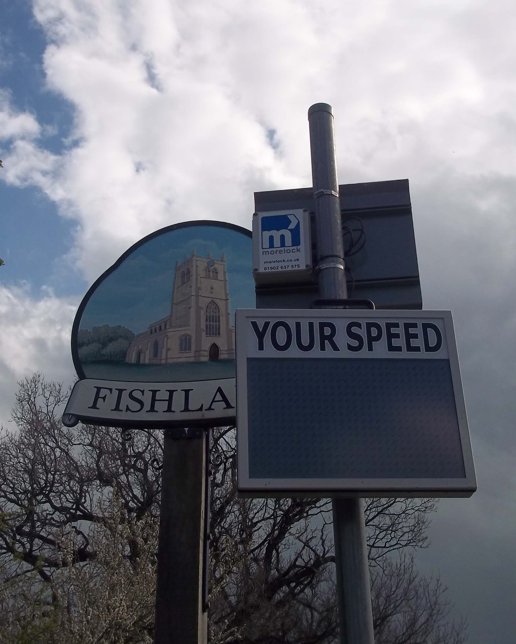
I continued down the road to Fishlake. The village welcome sign is obscured by a speed monitor and sign positioned only a few inches in front of it.


I arrived at my third closed footpath of the day. This meant that I had to walk along the road to reach Stainforth, but it did mean that I got a closer up view of the mill.