Showing posts with label themed walk. Show all posts

Saturday, May 9, 2020

Another Google Street View Virtual Walk Starting At Hulme End

Another themed virtual walk in Staffordshire today, starting from Hulme End. Appropriately today's theme is properties and locations with the word 'end' as part of their name.

Obviously I would have gotten off to a good start with Hulme End itself. I planned to walk back down the road towards Hartington for a few hundred yards and then take the first path leading off to the left. At this point I wouldn't have been very far from Endon House, about five hundred yards to the southeast.


I would have soon reached Hole End Cottage, then briefly walked along the road and headed northwest along the path which passes right next to some farm buildings known as Lowend. There's some sort of industrial activity taking place at a location prominently shown on the map as 'Townend'  over to the right, and over to my left I think I would have been able to  see a farm called Buttsend.

Next I would have turned to the right and walked along the road that passes next to the Townend site, from what I can see of it on Google Street View it looks like it's a factory 

After a couple of minutes or so I  should have found my next path ,taking me quite close to Bridge-end, a farm just to the west of Hartington. I'd then swing back to the west and walk through the village of Sheen and go down the bridleway to Brund.


My next planned destination was Ridge End Farm, a mile to the north along the Manifold Trail. I then would have headed west again, aiming for another location called Bridge End, this time written differently though.

Looking at the map I couldn't find any more places with themed names for me to visit on my return journey to Hulme End, using mainly footpaths I don't think I would have previously  planned to use.

Friday, March 6, 2020

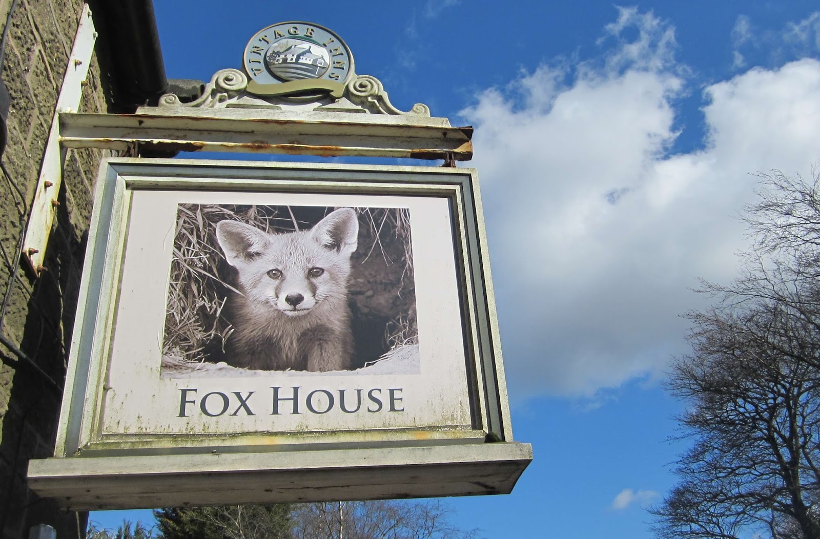
Dore Moor, Fox House, and Hathersage

Another one of my themed walks for 2020, today featuring animals, although some of the references are really contrived though...but I'm still counting them.

I travelled on the 272 bus just beyond a location called Owlet House, to the west of Dore Moor Inn on the way out of Sheffield. I wasn't far until I reached Sheephill Road, briefly walked along it until I found a path going up on to Houndkirk Moor. I continued heading to the northwest and after nearly a mile I came to within a few yards of the Ox Stones, over to my left - I went over to visit them.


[There are so many scowling faces that I can see in this image]


I walked across the moors and then along the top of Burbage Rocks and over to Fox House. Because of the muddy conditions I was stepping or leaping from rock to rock; a passing fellow hiker didn't understand my reference to hopscotch at all. A few minutes later I briefly chatted to a woman called Dawn from Birchover and then met her again in the beer garden at the Fox House Inn. She works with children who are autistic and we ended up discussing the more unusual aspects of Asperger's syndrome in particular for about fifteen minutes.


I headed northwest from Fox House along the path to the prominent Toad's Mouth rock perched at the side of the road  and then made my way to Over Owler Tor.

Toad's Mouth rock from certain angles really does look like a toad.


I took a photograph of the county boundary sign because the meaning of the name 'Derby' is 'village of the deer.'


This rock is called Mother Cap; 'Over Owler Tor' is rather unimpressive.


I then took the path leading up to Stanage Edge, scrambling up to the Cowper Stone and the path which goes along the top of the cliff. I had planned to loop further to the north and pass through two locations called Cattis Side and Cowclose but my left heel was getting a bit sore and so I made my way back down to Hathersage by the quickest possible route, passing just to the south of Leveret Croft. Ten animals on my walk today I think.


Saturday, February 8, 2020

Budby, Norton, Holbeck Woodhouse, Holbeck, Creswell Crags, and Creswell

My latest themed walk took me to places which have names which don't originate in England, although several are important in English, or British, military history.

I started the walk at Budby to the south of Worksop. Less than half a mile to the east, but with no public access because it's part of the Thoresby Estate, there's a footbridge over the River Meden that's marked on the map as 'Pierrepont Bridge' - it's a French word and the name of the family which resided in the hall for many generations.

I set off and headed to the south, soon reaching Ladysmith Plantation , named after a siege in the Boer War.

I then went to the west, keeping to the northern periphery of Budby South Forest until I turned to the right and walked along a concessionary bridleway to Hazel Gap on the Ollerton to Cuckney main road; Gibraltar Plantation was just off to the north. Over the centuries there have been thirteen sieges of Gibraltar; most of them not involving British forces though.  Further away Gibralter Lodge is marked as such on the map.


I continued walking along a bridleway, passing a large solar farm before arriving at Corunna Hill Plantation and Corunna Lodge. There was a battle and a siege at Corunna in the north west of Spain during the Peninsular War. Nightingale Plantation just to the north of here is a Crimean war reference of course.

Immediately to the south Battarain Plantation is located; I was sure this name would be included on my list because it doesn't look English at all...but I couldn't find any mention of the name anywhere.

There are a lot of ornate lodges in this part of Nottinghamshire; visiting some of them is a future themed walk that I'm planning...I wasn't counting, but I think I've photographed six of them on my walk today.

The next name certainly needed some research; Fasque, which although it looks French or Spanish, is actually the name of a castle in Aberdeenshire. Fasque Screed and Fasque Plantation were the other side of Carburton Dam, about a mile away.


This roadside monument commemorates Lord George Bentinck, the third son of the fourth Duke of Portland - it wasn't made from Portland Stone though, just some sandstone that's now quite weathered and eroded. 


I walked along the road to Norton,  I had a near miss with Bunker's Hill over to my left as I headed north and then northwest to Holbeck Woodhouse and then Holbeck.


Most of the herd was far away but these three fine specimens were quite near to the estate road I was walking along; they'd just escaped from the bale jail. 


I'd lost count of the number of lodges I'd passed by the time I reached this one.


The last time I was passing the church at Holbeck the lychgate was padlocked shut; fortunately I was able to explore the churchyard today...the church itself was still locked though.


This pretty cottage made a change from all the lodges.


I did a circuit of Creswell Crags and then caught the bus back to Worksop from Creswell.


Friday, January 24, 2020

Hathersage, Offerton, Shatton, Brough, Aston, Thornhill, and Bamford

There are quite a few small halls in the Hathersage area and the aim of today's themed walk has been to get as near to as many of them as possible. 

The bus I travelled to Hathersage on was the nosiest bus I've ever been on, especially when it was stationary at bus stops or traffic lights. Not only was the engine loud but everything on the bus, the seats, the windows, the panelling, and my skeleton would all vibrate and rattle, and even bang - I was glad to get off.


I got off in the centre of Hathersage; the nearest hall to where I was standing is Nether Hall, but the nearest publicly accessible spot to it is on the other side of the river and therefore a walking distance of nearly two miles...so I didn't bother; I did pass Nether Hall Farm though.


[Sorry about the unintended selfie]

At this point during the day the weather turned out to be much better than forecast; the light was just about perfect for taking pictures - it did cloud over later though.


The first hall I actually reached was Hazelford Hall about one and a half miles down the Grindleford road, and then along another country road - there's a footpath for most of the way though.


Only about half a mile away to the south is Leam Hall, well-hidden away and not close to any road or footpath.


Hog Hall wasn't very far away; a path goes right next to the perimeter fence surrounding the grounds.  I then headed west along the road to Highlow Hall; I didn't take any photographs there because there were people around. The walk to Offerton Hall took me through some more lovely countryside.


I was expecting the next hall to be three miles away, but about half a mile beyond Shatton I noticed this sign - on the map the property is named Upper Shatton.


There's definitely no hall at Brough. Rather than just walk down the road to Aston I went out of my way by using a footpath going across the fields and crossing over the railway line at Hope Station. Aston Hall is difficult to photograph because it's partially hidden by a high hedge or wall.


I continued heading eastwards to Thornhill and then over to the cafe at the garden centre for a pot of tea and a chocolate chip shortbread biscuit. I timed my departure so that I didn't have long to wait for the bus at the nearby bus stop.