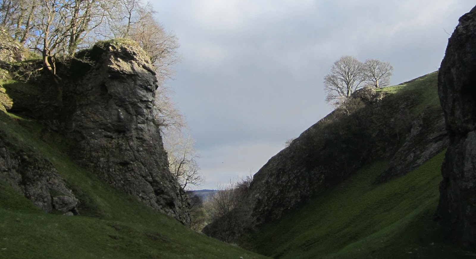
Showing posts with label Cave Dale. Show all posts

Monday, March 16, 2020

Castleton, Mam Tor, The Great Ridge, and Hope

I did the Great Ridge Walk from Castleton today, the first time I've done it for several years. Just to make sure that I couldn't escape from the real world and the coronavirus the bus driver was wearing a face mask that looked like something out of a science fiction film...and more was to come later. 


I headed out through Cave Dale and then across to Mam Tor and along the ridge to Lose Hill, and finished at Hope with a pot of tea and a delicious moist fruit flapjack. 


My dad rang me on my mobile when I was on the Great Ridge; he very rarely phones me at all, even on the landline. Naturally I was concerned when I answered - he was worried and a bit flustered and initially just asked me what was going on and then proceeded to tell me about the large crowds at the shops and all the shouting and arguing, pushing and barging as people grabbed things off the shelves. Even though I've been telling him about the coronavirus and the forthcoming lockdown he's not really taking in the gravity of the situation; he just thinks it's a bit of a laugh. I'm due to be meeting him in a pub in town, plus my brother and a friend who's also vulnerable and we'll be having an emergency briefing...it could well be the last time for many months that we'll all see each other. After tomorrow there'll most likely be nothing else I can do for any of them. I'm ready, and have been for five years because I anticipated something like this happening...but I'm not sure about them, any of them. 

I bought the final few essential items yesterday that I consider I'll need, including a spare tin opener, some nail clippers, and two packets of vegetable plant seeds.


The toilets at the Old Hall Tea Rooms in Hope are inside the pub, guarded by a suit of armour carrying a halberd.


Sunday, May 19, 2013

Great Hucklow, Windmill, Old Dam, Beytonsdale, and Castleton.

The guard on the train this morning announced that we would be ten minutes late leaving Doncaster due to overrunning engineering works. This meant that I'd miss the 272 bus at Sheffield, and so would have to catch a later service, to a different destination. After checking my bus timetables, which were still wet after last week's soaking on the Great Ridge, I decided to catch the 65 and start my walk from Great Hucknall. Fortunately there was plenty of room, and even a table, for me to re-fold my map en route. There was plenty of time at Sheffield Midland Station to visit the toilets and pop into the Sainbury's shop there and buy something extra to eat. All I could find was a packet of Welsh cakes; I've never tried these before, in fact, until today I'd never heard of them. They looked a bit like Derby scones, which I think are delicious (never served as part of a cream tea though). Later in the day I was to find out that they didn't taste that much like Derby scones; they were much lighter and not as buttery...but did contain more currants. There were six in the pack and I ate them all; so I must have enjoyed them.

I got off the bus as planned at Great Hucknall and walked through the village, then along the road and a path that goes parallel to the road, until I reached the hamlet of Windmill. There were some pretty views along this section; spoiled somewhat by the poor visibility though. A few hundred yards beyond Windmill there's a gate which is the access to High Rake. Almost immediately there are the ruins of High Rake Mine, with a detailed information board, and a bench facing northwards to  appreciate the view of  Hucklow Edge over to the east. It was 10:45 by now and so the cricket commentary was just beginning: time for my sandwiches and a rummage in my rucksack for my radio. As I ate my sandwiches and Welsh cakes, England got off to a bad start for the day; they did easily win the test match against New Zealand by mid-afternoon though.

Here's a photograph of part of the information board at High Rake Mine; the part with the largest lettering.


I continued walking along High Rake and then crossed a narrow country lane and took the path that continued in the same direction. I was now walking along, and sometimes in the bottom of, Tideslow Rake. This is a very prominent, and impressive landscape feature, the largest in the Peak District I think. Here are two photographs I took, facing both directions, to try and show how large it is, stretching for over a mile - all dug by hand I should think.


When I was in the bottom of the rake I heard the sound of a loud engine and looked up to see a low-flying light aircraft; a very small one - a very flimsy single-seater.


After reaching the end of Tideslow Rake I walked along the road for a short distance and then took a path across the field, and then a single track lane, to Old Dam. I continued along this lane to reach Beytonsdale, a hamlet I hadn't visited before.

I took another path leading uphill across more fields and then reached the road, right next to Eldon Quarry. Just before reaching the quarry I saw an eviscerated frog on the grass.


I walked along the old quarry road and then along the section of the Limestone Way which leads down Cave Dale into Castleton. 

As I was approaching Castleton the weather rapidly improved, as you can tell  from this picture I took at the bottom end of Cave Dale, only about a hundred yards from Castleton's market place.


The bus was waiting in at the bus station; service number 273 which goes to Sheffield via the Ladybower Reservoir and the Upper Derwent Valley. The journey back to Sheffield was lovely, especially the section when the bus travels the entire length of the reservoir's upper arm to the visitor centre at Fairholmes. The last time I was here I was in a car with two friends from Leeds listening to Wagner on the CD player...and that was even better. 

I had time to get a cup of tea at Sheffield railway station; however I had to stand on the train, struggling with my drink as it slurped about in the plastic cup. I had a bit of an accident as the train turned sharply to the right just beyond Swinton station when what should have been a sip of scolding hot tea ended up inside my nostrils. Strangely, the hot tea didn't seem to drain back out from my nostrils though.

Sunday, November 11, 2012

Castleton, Bradwell, Brough, and Hope.

Some people had a good start to their day this morning; the guard on the train didn't collect any fares. He seemed to be rather busy frantically pacing up and down the carriages, but doing nothing else that I could make out. Of course, I didn't benefit personally because I have a free travel pass anyhow.

I started today by walking up Cave Dale, for the first time this year I think. Access from Castleton is very easy; just head for the Market Place and go slightly up the hill to the left and just look for a cleft in the rocks between two cottages to the right. There's a short path squeezed in between overhanging rock faces...and then, there you are; in front of you is a gate with an information board telling you all about the Limestone Way, which begins, and ends, at Castleton. There's also a sign at the side of the road which indicates Cave Dale.

The early morning sunshine was perfect for seeing Peveril Castle at the top of the rocky crag; this photograph was taken probably no more than a ten minute walk from the shops and tourist facilities of this popular village.


As I climbed and got higher up than the castle, Win Hill and the Great Ridge came into view; again, perfectly illuminated.


When I reached the head of the dale the weather conditions changed dramatically, the grasslands of Old Moor were shrouded in mist.

At the junction of five paths or tracks I turned left and headed towards Bradwell; firstly along a well-maintained track often used by motorised vehicles, then a short section of path across fields, and finally along the road down into Bradwell. I took a short detour to visit the observation platform overlooking the active quarry workings at the Hope Cement Works: being a Sunday there was no activity to observe though.

After a brief visit to one of the village shops I found the path which goes across the fields to Brough. Although the chimney and the plant buildings of the cement works are always in sight, there are still some lovely views to be had along this section.


At Brough I walked across the site of the Roman Fort (NAVIO or ANAVIO). The footpath goes right across the archaeological site, I don't know if any artefacts have been unearthed but there was a couple kicking over new molehills, possibly hoping to find something.

The last mile or so approaching Hope was absolutely idyllic. The low angle of the sun was casting long, dark shadows in the foreground, in the middle distance deciduous trees were shedding the last of their leaves, and on the horizon Win Hill and the Great Ridge were bathed in sunshine.


Lovely.

Sunday, September 16, 2012

Castleton, Little Hucklow, Coplow Dale, and Bradwell.


After having walked through Castleton from the bus station I climbed up the steep grassy slope at the far side of the wooded area next to the castle, to reach the path which goes parallel with, and high above, Cave Dale. Although not signposted, and a challenging climb, this short section is a footpath, the approximate route being depicted on the Ordnance Survey map: certainly, I've come down here before, and seen other people also use the route.

This path merges with the Limestone Way at the top of Cave Dale. I continued for a few minutes before I reached a junction of five footpaths or bridleways and took a route across Old Moor I hadn't previously walked. I was heading in a south-south easterly direction for about two and a half miles, the route at first being a footpath across grasslands, then a track, then a brief section of country road, and finally a green lane; or 'bridleway open to all traffic' - otherwise known as a 'BOAT'.

I then turned left and took the road that leads to Little Hucklow, a village I haven't really explored before. I noticed something that briefly interested me; a garden gate with a very high step leading up to it. You can see from the photograph that the step is nearly as high as the gate, and the gate looked to be a normal size to me.


It was a short walk along an overgrown footpath to Coplow Dale and then a pleasant walk across fields towards Bradwell, with some lovely views of Bradwell Edge, the Hope Valley...and beyond. I did get a splinter in my thumb though when climbing over a stile; we call a splinter a 'spell' in Yorkshire dialect...I wonder if they use the same word in Derbyshire?


I knew that the route down into Bradwell Dale is steep and difficult because I've previously climbed up it; so I walked along the top lane, passing by what I assume to be the entrance to Bagshawe Cavern - there was a group of people struggling to get into caving gear.

I took one of the paths which leads down into the centre of Bradwell, arriving there at 1:40, hoping for either some fish and chips or an ice cream from the ice cream shop...yes; that's all it sells, and as I discovered, it only opens for a few hours each week. The fish and chip shop doesn't open at all on Sundays...but I'd be able to get an ice cream at two o'clock.

I spent a few minutes reading the information board at the entrance to the small park and then visited the toilets. It's the first time I've used these facilities; on previous occasions they've been closed - like most public toilets in the Peak District they were clean and well maintained and serviced though.

I was waiting outside Bradwell's shop when it opened; Bradwell is the name of the family which makes and sells the ice cream...it just happens that their dairy and shop are also in Bradwell.

I was confronted with the entire range of flavours available...nineteen in all. I treated myself to a twin cone, double chocolate chip and lemon curd. Delicious.

The bus was due ten minutes later, and arrived about five minutes late.


Sunday, January 15, 2012

Miller's Dale, Peak Forest, Old Dam and Castleton.

Although the train for Sheffield was powered up and ready to leave, no passengers were allowed to board; it first had to be moved to another platform. To me this seems a rather stupid thing to do, since it's the first departure of the day and obviously not interfering with any other service, yet there must be some logical, easily-explained reason: maybe the Sheffield track couldn't be accessed from the original platform, or the signals and points had been pre-set overnight...I don't know.

Including Miller's dale, I visited six dales today; and walked the entire length of five of them. Monk's Dale starts at the hamlet of Miller's Dale, and is reached by taking the footpath right at the side of the chapel. There's a short climb before you descend into the wooded valley.


The photograph was taken at the top of the short climb; it's actually in colour, but the frost makes everything seem monochrome.

For the majority of this walk I was walking in the dale bottoms. Monk's Dale is mainly wooded and the path is strewn with moss-covered stones and fallen trees; if it weren't for the effects of the keen overnight frost some sections which were very boggy would have made very difficult walking conditions.

After nearly ninety minutes I reached the top of the dale, crossed the road and entered my third dale, Peter Dale, a much shallower and more open dale; and only just over half the length of Monk's Dale. I made fairly quick progress.

Next up was Hay Dale, itself shallower, more open and shorter than Peter Dale. The first two observations also apply to the next dale, Dam Dale, when comparing it to its predecessor - it is slightly longer than Hay Dale though.

After walking along valleys for nearly five miles I arrived at Peak Forest, crossed the main road and took the lane which leads to the hamlet of Old Dam; my first visit there.

Unusually, the toughest climb came towards the end of the walk - it wasn't that difficult though as I steadily climbed across the fields to reach the high limestone grasslands above Castleton and bagged my final dale of the day, Cave Dale; which was a difficult descent today due to the large amounts of water and the slippery rocks.

I had time in Castleton to enjoy some fish and chips this time. By the time I had eaten them the sun had set and it was getting rather cold. As I was sitting in the bus station waiting for the bus I began to shiver and feel a little uncomfortable; possibly because I'd been sweating a lot earlier and my clothes were now damp.

I broke open one of those chemical hand waters: it wasn't very effective though.

Sunday, June 5, 2011

Ashford-in-the-Water, Sheldon, Magpie Mine, Lathkill Dale, Over Haddon and Bakewell.


Today's walk was over ten miles in length; the longest walk I've done since starting the blog. I'm feeling really well; it seems the latest dose of antibiotics is being effective in clearing up my bronchitis.

I got off the bus at Ashford-in-the-Water, a village I've visited before, but never had the time to linger since I was always in a hurry to get back to Bakewell. I enjoyed admiring many of the cottage gardens today and lingered a while at the old stone bridge over the River Wye until I spotted a couple of trout.

The walk to Sheldon is a bit of a slog but the views are worth it. I then walked across the fields to the Magpie Mine and spent about twenty minutes exploring the substantial ruins which remain.


I then navigated to the head of Lathkill Dale near to Monyash and sat down on a grassy slope to enjoy a bit of sun on my face; I was briefly shocked, when, for a fraction of a second, I thought a nearby twig was actually an adder ready to strike.


I've not walked along the upper reaches of Lathkill Dale before and it was a pleasant surprise; being quite rocky and reminiscent of Cave Dale near Castleton.


I made good progress along the dale and stopped to take a photograph of an interesting sign referring to an ancient and obscure bye-law.


Finally, I walked to Bakewell along a different route.