I'm self-isolating because of the coronavirus outbreak and so won't be able to go walking for several months I should think. This coming weekend a new bus service was due to start going from Sheffield to Alton Towers and passing through many parts of the Peak District that I'd not been previously able to reach. I'd been very excited about this and had been researching the places I'd be going and planning the routes I'd be walking in quite a bit of detail using Ordnance Survey Maps and Google Street View. I've already made extensive notes and so I thought I might as well make use of these to write up virtual walks using images from Street View that I've cropped to my liking.
The first place that I'd planned to travel to on the bus would have been Hartington. I've only visited the village once, that was with my friend Chris from Leeds - we didn't stay there very long because we were in a hurry to get back to the car.
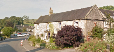
So...I'll start by exploring Hartington using Street View.


I then planned to head south, going across the fields and then down into the upper reaches of Beresford Dale where I would have spent quite a bit of time taking photographs if the weather was good. I'd only be walking for about half a mile in the dale though before taking a track and the a footpath which leads through the gap between Narrowdale and Gratton Hill.
It would then have been only a few hundred yards until I arrived at Alstonefield, a pretty village across the county boundary in Staffordshire.


I've enjoyed writing this virtual walk and hope people enjoy reading it too; it's obviously not the real thing, but it's the best I'll be able to manage until at least quite late into the summer. I will continue regularly updating with all of the other walks I've planned and look forward to the next time I can set foot in the Peak District.
No comments:
Post a Comment