Showing posts with label Rivelin Valley. Show all posts

Monday, November 18, 2019

Malin Bridge, Load Brook, Ughill, Low Bradfield, High Bradfield, Foldrings, and Oughtibridge

Public transport ran on schedule for me today; three trams, two trains, and a bus. After arriving at Sheffield this morning I caught the tram to Malin Bridge and then headed straight down into the Rivelin Valley Nature and Heritage Trail.


I nearly bumped into a jogger because neither of us knew which side of the path to move to; it's generally a lot simpler when I encounter mountainbikers - quite often they'll yell out 'To Your Left' or 'To Your Right' and pass on that side.

I didn't go right to the end of the trail, instead I climbed out of the valley just before the parking area at Tofts and walked up onto the high fields.

I headed west towards Bradfield, passing through the hamlets of Load Brook and Ughill.; I stopped to photograph this piece of agricultural machinery - I was intrigued by the scrubbing brushes.


At a junction of two roads on my way down to Low Bradfield I noticed some sort of monument or obelisk over to my left. There was an inscription and a date but it was well worn and indistinct. I shall do some online research later and post any information I find.


It's dangerous to walk up the road from Low Bradfield to High Bradfield; fortunately there's a lovely footpath across the fields. It's a fairly steep climb and at the top I was ready for my glass of Diet Coke or whatever it was, at the Old Horns Inn.

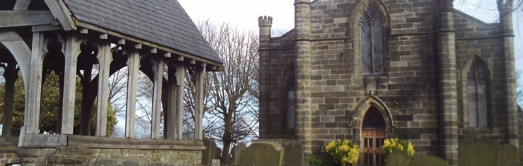
As usual I took some photographs of the village church.


I left High Bradfield by taking the footpath that goes off to the northeast and the next place I arrived at was Foldrings. I then walked through some woods and down the road to Oughtibridge. Many of the views in this area are spoiled by pylons and power lines - I did manage to compose these three images though...with quite a bit of cropping required for the final two.


UPDATE:
 Hoar Stones Road near to Edgefield Farm, above Bradfield. This unusual building is described, in Roger Redfern's book Portrait of Bradfield Dale, as being built over a roadside spring and was erected over the spring after a child drowned there in 1832. The Obelisk is in memory of this sorrowful event.

Thanks to Mick Walpole, replying on the Peak District Past and Present Facebook page.


Sunday, February 4, 2018

Ladybower Inn, Moscar, Hollow Meadows, Stannington, and Malin Bridge

I got off the bus at the Ladybower Inn, crossed the road and headed up the footpath onto the moors. I soon reached a section of path that had recently been repaired and a pull-out [and up] wooden tree identification board installed.


I tried to take a photograph with the panel extended...but I really needed an extra arm; whenever I pushed the shutter release button using one hand the camera moved so that I didn't get the image I wanted...not at all. 

The best views were behind me along here, looking back towards Win Hill.


The weather was still quite murky so there weren't a lot of good opportunities for photographs; this one I took of the old milepost turned out alright I suppose.


When I reached the ford near Cutthroat Bridge I stopped and had a brief chat with a student who was genuinely panning for gold; he had all the professional equipment by the look of things. I didn't want to disappoint him too much but did mention that I didn't know about any gold deposits anywhere in the Peak District. He seemed to be enjoying what he was doing though and so I left him to it - maybe it was a university project that he was working on.

I checked my map as I reached Moscar House, not just to check for directions but also to confirm that I was correct about a geographical curiosity in this area. There's nothing at all to see at Moscar, it's merely a collection of a small number of isolated farms up on the moors. The fact that makes it a bit interesting, for myself anyhow, is that there are several premises all of which feature 'Moscar' in their name...and they are located in three different local authority areas; High Peak Borough, Derbyshire Dales, and the City of Sheffield.

I continued walking eastwards towards Sheffield, quite often along the road, but sometimes taking a short section of footpath whenever I could...usually adding a few hundred yards to the distance.

Underbank Unitarian Chapel is just to the west of Stannington.


The Anglical church is about a mile further on in the main part of the settlement, which is a suburb of the city.


I'd already checked on Google Streetview where the footpath leading down to the Rivelin Valley was; it's a narrow snicket between two houses, which I could have easily missed.

The walk finished at the tram terminus at Malin Bridge and everything went according to plan all the way home on public transport.


Sunday, June 11, 2017

Fairholmes to Malin Bridge

Sometimes a few young women  get on the early train after enjoying themselves in the nightclubs in town on Saturday night. Naturally they are usually wearing quite revealing clothing...which always puts a smile on my face when I notice them. Today, however, I was in for a real treat; one young woman who was wearing practically nothing, just a skimpy pair of knickers and a flimsy toga that wasn't even properly held in place. When she walked by me on the train I got a right eyeful of naked flesh - her friend wasn't wearing much more, just beachwear, a thong and a couple of red stars covering her nipples.

My bus from Sheffield arrived on time at Fairholmes, and after visiting the toilets there I headed up onto the moors via the dam and a few isolated cottages.


I took the Wellhead path, which leads up to Dovestone Clough, a route a haven't walked along previously. There were some lovely views as I climbed up here, mainly looking behind me, and they'd look even better in the sunshine.


I then walked across open moorland for a bit and found the easiest way to get up to the Salt Cellar rock formation, climbing through the heather, bracken, and bilberries...it was quite tiring.


From this point onwards it was a steady descent along the top of Derwent Edge and then across the moors to Moscar House and then a bit more undulating past Moscar Cross Farm and across Ughill Moors.

The next section of the walk was along country lanes, tracks, and footpaths, passing the hamlet of Load Brook en route. There was some decent countryside to enjoy and take photographs of.


Only a few minutes after this point it started to rain; the clouds looked very threatening and I thought it was set for the day, and so instead of heading down to the Rivelin Valley and walking all the way to Malin Bridge I decided to bale out and head for the nearest bus stop at Stannington.

When I reached the bus stop I cursed because I'd arrived there five minutes after the bus had left and it was fifty five minutes for the next one. I continued walking towards the direction of Hillsborough and a few minutes later I noticed a timetable on another bus stop showing that two services stopped there on a Sunday - yet again though I was a few minutes late for the additional service. So I kept on walking, fortunately the worst of the rain had passed over.

I wasn't really sure exactly where  I was by this time, I had walked off the edge of the map...but I knew where I needed to be - in the bottom of the valley. I headed straight down a steep hill on a housing estate and arrived not too far from the tram stop at Malin Bridge. When I got there, there was a tram waiting for me on the platform ready for the journey back to the city centre.


Wednesday, October 19, 2016

High Bradfield, Low Bradfield, Rails, and Malin Bridge

I got off the bus at High Bradfield, took some photographs and then walked down a short footpath from the church to the steep road that goes down to Low Bradfield. According to the map there's another footpath a little further down the road which then would have taken me across the fields to Low Bradfield: I couldn't find it, so the road had to do.


I followed the southern shore of Damflask Reservoir for a few hundred yards until I took one of several paths up to the road. I was hoping to locate the path that would lead me uphill to Oaks Lane. This turned out to be the second footpath I missed and so had to do about an extra quarter of a mile walking along the road until I reached Low Woodhouse. Low Woodhouse is just a farm, but it's quite interesting; the footpath goes through a couple of homemade gates and then you're in the orchard where you have to make your own way towards the back garden and then up the drive and away from the property. The reason why I state that this part of the walk is interesting is because the owner of the property has positioned several interesting displays of old agricultural equipment and implements in the garden; for people to look at I presume - there must be at least a dozen, all painted in bright colours.


The next few miles until I reached Rivelin Valley required me to regularly consult the map. There's a complicated network of footpaths, byways, green lanes, tracks and minor roads to be navigated. In places there are some nice views though, my particular favourites are the views towards Hillsborough.


When I started walking down the Rivelin Valley I noticed that some new information points had been installed.


I was ready for a pot of tea when I reached the cafe, which is run by the 'Pudding Ladies.' There were a lot of delicious [I should imagine] and very well presented cakes, but since my diabetes diagnosis I have to forego this little pleasure. As I was sitting at my table I had an excellent view of one of the young women who works there, she was very lithe and petite and was sitting in the lotus position on a high, narrow shelf and occasionally moving her hands when she was writing all the different types of coffee that the cafe sells, on a large blackboard. I was intrigued as to how she would get down; I thought it would be rude to stay when I'd finished my tea...and anyhow I wanted to get back to Sheffield before the rush hour.

A few minutes later I arrived at a chair that I wouldn't be able to sit on, a piece of outdoor art positioned on an inaccessible rock in the middle of the river.


I got a seat on the tram to Sheffield Railway Station, but I had to stand for most of the way on the train back to Doncaster.

Saturday, June 23, 2012

The Meanwood Valley Trail, Leeds.

I just walked along this route with a friend from Leeds Adult Asperger's Group.
http://en.wikipedia.org/wiki/Meanwood_Valley_Trail

The terrain and scenery is a bit like the wooded valleys that lead down into the urban areas of Sheffield, the Rivelin Valley, Porter Valley, Limb Valley and Loxley Valley ...naturally it's not as hilly though, but the countryside is fairly open towards Golden Acre Park at the end of the route.

One thing I did notice is that the footpaths are not as clearly marked as they are in Sheffield.