I got off the bus at the Ladybower Inn, crossed the road and headed up the footpath onto the moors. I soon reached a section of path that had recently been repaired and a pull-out [and up] wooden tree identification board installed.

I tried to take a photograph with the panel extended...but I really needed an extra arm; whenever I pushed the shutter release button using one hand the camera moved so that I didn't get the image I wanted...not at all.
The best views were behind me along here, looking back towards Win Hill.

The weather was still quite murky so there weren't a lot of good opportunities for photographs; this one I took of the old milepost turned out alright I suppose.

When I reached the ford near Cutthroat Bridge I stopped and had a brief chat with a student who was genuinely panning for gold; he had all the professional equipment by the look of things. I didn't want to disappoint him too much but did mention that I didn't know about any gold deposits anywhere in the Peak District. He seemed to be enjoying what he was doing though and so I left him to it - maybe it was a university project that he was working on.
I checked my map as I reached Moscar House, not just to check for directions but also to confirm that I was correct about a geographical curiosity in this area. There's nothing at all to see at Moscar, it's merely a collection of a small number of isolated farms up on the moors. The fact that makes it a bit interesting, for myself anyhow, is that there are several premises all of which feature 'Moscar' in their name...and they are located in three different local authority areas; High Peak Borough, Derbyshire Dales, and the City of Sheffield.
I continued walking eastwards towards Sheffield, quite often along the road, but sometimes taking a short section of footpath whenever I could...usually adding a few hundred yards to the distance.
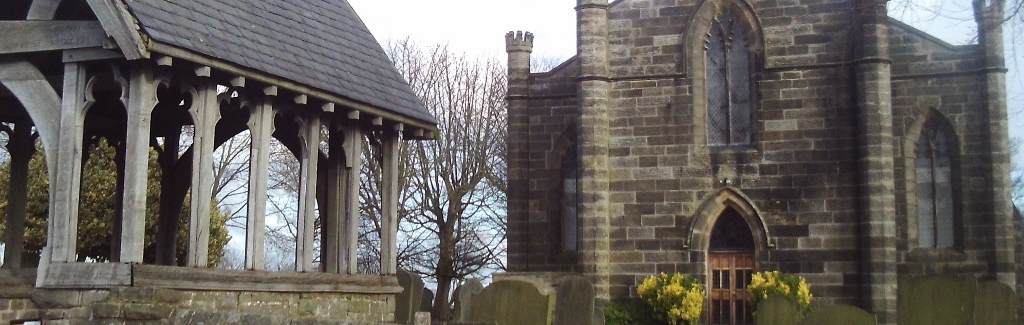
Underbank Unitarian Chapel is just to the west of Stannington.


The Anglical church is about a mile further on in the main part of the settlement, which is a suburb of the city.


I'd already checked on Google Streetview where the footpath leading down to the Rivelin Valley was; it's a narrow snicket between two houses, which I could have easily missed.
The walk finished at the tram terminus at Malin Bridge and everything went according to plan all the way home on public transport.
No comments:
Post a Comment