Showing posts with label Great Sheffield Flood. Show all posts

Sunday, August 18, 2019

Fairholmes, Low Bradfield, Holdworth, Loxley, Malin Bridge, and Hillsborough

A much longer walk in the Peak District today after yesterday's short walk with two friends along Froggatt Edge. The day didn't start well though, I arrived at Doncaster Railway Station to discover that the early train to Sheffield had been cancelled...no replacement coach provided, no information on the screens, no staff to be seen anywhere... So, I had to catch the bus which takes a lot longer but I still arrived at Sheffield just in time to get on the bus going to Fairholmes.

I walked over to the dam and then continued along the track that goes alongside the eastern shore of Derwent Reservoir.


After three quarters of a mile I reached a footpath which was going up onto the moors. I travelled eastwards across the  high ground for about three miles until I arrived at the road just north of the Strines Inn.


The trig point at Back Tor was the highest point I reached on my walk today.


After walking along the road for a few minutes I took the concessionary footpath which goes through the woods alongside the northern, or western shore of Dam Dike Reservoir. There's a memorial to the victims of the 'Great Sheffield Flood' of 1864 when the dam wall collapsed, and there's also an information panel about the disaster when at least 240 people died - I didn't take any photographs though because there were several people at each location and I didn't want to be seen as conspicuously waiting for them to move away.


There was more roadwalking down into Low Bradfield and then it should have been footpaths across fields all the way to Loxley...however, I lost my path and ended up walking on the road again for most of the stretch to Holdworth. My route went over the fold of the map so I didn't bother to check where I was going.


Low Bradfield is a pretty village. There are some tearooms there which I haven't visited yet.

When I joined the footpath at Holdworth I was walking along the Sheffield Country Walk - I left it just before Worrall to take a more southerly route towards Loxley Common and then Wadsley Common.

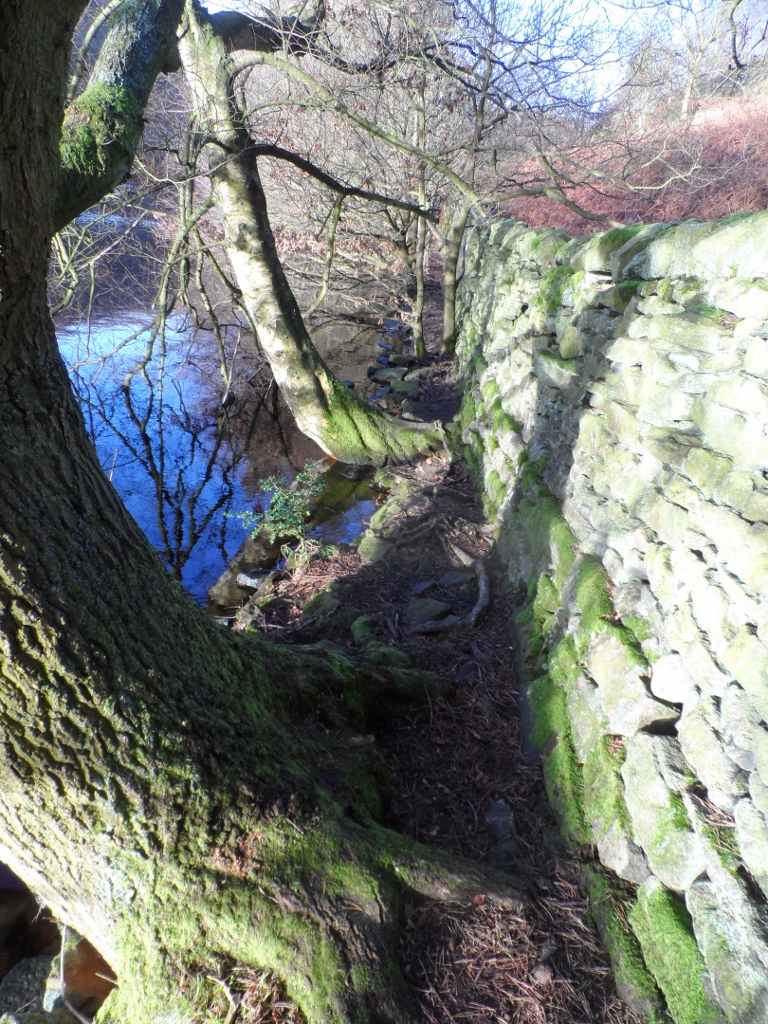
I went through  some extensive woodland on my approach to Loxley - I'd not been that way before, and my descent into the Loxley Valley was all new to me as well. I couldn't catch a tram from the terminus at Malin Bridge because the tracks are being replaced. I had to walk a bit further to Hillsborough where trams were running to the city centre though.

My train back to Doncaster was eight minutes late departing, but at least it wasn't cancelled. It wasn't a good day for public transport today.


Wednesday, March 8, 2017

Lodge Moor, Rivelin Dams, Ughill, and Low Bradfield

As usual the number 51 bus was packed with schoolchildren so my journey out to the terminus at Lodge Moor was rather unpleasant - but I arrived there unflustered and unscathed. 


I dropped straight down into Fox Hagg Local Nature Reserve; I noticed that the first, and steepest section of the bridleway had been re-surfaced since my previous visit. Further down it got very muddy underfoot in places as I walked through woodland to reach the Rivelin Dams and the Wyming Brook Nature Reserve at the bottom of the valley.

There's a small car park at the entrance to the nature reserve and a lay-by at the other access point on the A57 road. As I approached the latter I noticed at least four small plastic bags most likely containing dog pooh...maybe it would have been better if the dog walkers had just let their pets do their business and not bothered to pick it up and bag it. Certainly the environment would look a lot cleaner...but at least I suppose the drinking water supply isn't getting contaminated.

I walked along the busy main road for a short distance and then took the first path leading up to the right, a steady, gentle climb up to Crawshaw Lodge. There's a sign on the gate that reads 'Beware of the Dogs' - I was more concerned about the peacocks, I counted at least seven of them. 

I made quick progress along the track across the moor to Crawshaw Farm, and then Ughill. I had to stop and take a photograph of the direction signs at the junction of two roads.


It's not a very good photograph of some not particularly attractive countryside...but I couldn't resist an image which includes the words or phrases, 'Ugh, Tinker Bottom, Dung, and Burglars Beware.'

I passed through Ughill, there are only about half a dozen farms or houses there, and continued along the road until I reached a footpath which took me across the fields to another stretch of road, and then a path downhill to Dale Dike Reservoir. Towards the bottom of this section the footpath which goes through the forest was closed because of tree felling and so I took what was marked as the diversion...well it wasn't, I got a bit confused trying to remember exactly where I should go and ended up just heading directly for where I wanted to be, climbing over a fence and two walls to finally get there.

It was quite busy as I was walking alongside the reservoir; a dog wearing a nice red woolly coat approached me and so I asked it how it managed to keep the coat so clean. Almost instantly its female owner answered telling me that the trick is not to walk where it's muddy; a few minutes later five greyhounds sniffed my crotch, each in turn...not saying a word between them.

I always take a photograph of the pump house when I pass it...and the memorial stone to the victims of the Great Sheffield Flood a few yards further on.


Finally I walked down the road to Low Bradfield, well actually the bus terminus at the edge of the village: the view from there is quite pleasant.


My journey home to Doncaster was thankfully uneventful. The weather in the Peak District today wasn't very good, mainly overcast with a cold wind...but when I arrived back home it was sunny and warm. This isn't too surprising though because I think the weather in Doncaster is significantly better than the upland areas of the country such as the Peak District.

If everything goes according to plan I'll be going on the bus to Gainsborough tomorrow with my friend Justin - something that I couldn't have done six months ago when I needed at least a day to recover from a walk.


Saturday, January 23, 2016

High Bradfield, Low Bradfield, and Malin Bridge

A return to the Bradfield area today, visiting three of the local reservoirs.

I was glad to get off the bus, the engine was making a high pitched screaming or squealing noise that seemed to bounce about inside my head and churn my bowels and stomach. I paused to take some photographs of the church at High Bradfield, and some nearby buildings before heading in a westerly direction towards Agden Reservoir.


A few yards beyond the churchyard and I got my first view of the first reservoir of the day.


There was a steep descent down to the reservoir and then a very pleasant walk right next to the water, initially a gravel path, but later on just a footpath through the woods. I lost the main route of the footpath and ended up having to actually walk in the water and then crawl through a gap that had been made in some railings.


After walking along the track for a few minutes, passing several joggers and dog walkers, I arrived at a bird village consisting of at least a dozens feeders and nesting boxes. There was a seat to enjoy the view. It was early, but I was hungry and so ate my sandwiches and then took photographs and a short video of the birds; they seemed to be the prettier species, robins, finches, and tits.


Here's a link to the video. You can see the different types of birds.

Not much further along there was an impressive group of waterfalls tumbling out of pipes passing under a bridge.

I took a couple of short videos at this spot.


I then had to walk along the road for a few hundred yards before taking a path that led me down a pretty and comfortable grassy bank. There was another short section of road, very short this time though, before I found the concessionary path goes along the northern bank of Dale Dyke Reservoir. Only a few dozen steps later I found the memorial plaque for the victims of the Great Sheffield Flood.


Although I've never lived in Sheffield, I've never lived that far away from the city, and I've always known about the 'Sheffield Flood.' When myself and my brother were children and either of us needed to go for a pee, a pee which took a long time, my mother would shout up the stairs, "It's like Sheffield Flood up there!" 

Just beyond the plaque I had to make a decision; to stay on the northern bank and walk all the way around the reservoir or take the path that goes at the bottom of the dam and work my way back towards Bradfield, Low Bradfield this time. I decided to take the shorter route, and was really glad I did because within minutes I stumbled upon a couple of mysteries - they are mysteries to me, but probably aren't mysteries at all to anyone who knows anything about reservoirs and water supply.

The first mystery was at the bottom of the spillway where I noticed some solar panels had been installed to power some orange-coloured underwater fluorescent lighting.


A few minutes later my next mystery appeared; parallel straight lines of bubbles in the water. To me it looked like some pipes might have been laid on the floor of the reservoir to let air oxygenate the water. They look like lanes at swimming baths.


I climbed up through woodland to reach the road that goes down to Low Bradfield, where I had a chocolate break sitting at one of the picnic tables next to the old bridge.


I passed even  more joggers and dog walkers as I walked along the southern shore of Damflask Reservoir, my third reservoir of the day. The walk was completed by me walking along the Loxley Valley back to Malin Bridge; there are several derelict mills and factories along the way...which I took the time to explore.


Monday, November 16, 2015

Bradfield Area Walk

There's a new bus service from Sheffield City Centre out to Bradfield so I thought I'd catch it today; it only took thirty minutes to arrive at High Bradfield.

As soon as I got off the bus I crossed the road to take my first photograph; I'm not sure if the Tour de France actually came to Bradfield though, I thought it went further north.


I walked through the churchyard and then on past Bailey Hill.


There were quite a few different types of landscape for me to enjoy before I reached the road that leads to the gated access to the moors. This seat would have been a lovely spot to eat my sandwiches, but I'd already eaten them.


I made use of 'Duke Road' to cross the moors; it's quite easy walking conditions and doesn't really require any navigation skills. For part of the way it's a track used by four-wheel-drive vehicles to reach the grouse butts, and further on there's a paved section across the  boggy stretches. Because of the strong wind I found it  quite difficult at times though; I struggled to breathe and was coughing a lot.

I arrived at Back Tor unscathed, but decided not to climb up to reach the trig point.


After a few hundred yards I turned left, starting my return to Bradfield, taking the track that leads down to the road, then continued along a path high above Dale Dike reservoir.


I finished the walk at Low Bradfield after walking along the road for about a mile.

All of today's walk was in just the one parish, Bradfield Parish; it's a large parish, possibly the largest in England - I'm not certain though.