Showing posts with label Brodsworth Community Woodland. Show all posts

Sunday, January 31, 2021

Walking To My Nearest Trigpoint

I spent a few minutes resarching this online, and my nearest trigpoint turned out to be where I thought it would be, at Pickburn, about five miles from where I live. By the way, a trigpoint is a low, pyramidal concrete pillar used for surveying by the Ordnance Survey many decades ago. 

After walking through the town centre I used a stretch of the Doncaster Greenway. There are several railway themed benches installed at various locations along the network of trails; I photographed two of them today.


I reached Highfields Country Park and then Brodsworth Community Woodland. 


The location of the trigpoint as at the side of the road at the start of the bridleway that goes to Hooton Pagnell. I've been a bit suspicious that this has always been the location of the pillar though, it looks as if it's just been dropped there after possibly being moved from another location.


I continued beyond the trigpoint, dropped down into Brodsworth and then walked along the country road which would get me back to town as quickly as possible.


After a few hundred yards there was a footpath sign, this was the start of a path I'd not used before; that always adds a bit of extra interest to a walk. I walked through a wood at the back of the houses on Green Lane and then joined the cycleway which goes along the Roman Ridge to within less than two miles from the town centre.


UPDATE: Here's the map showing the location of the Stirling Single bench that Richard asked about in his comment.


Monday, December 17, 2018

Woodlands, Pickburn, Hooton Pagnell, Stotfold, Phoenix Park, Goldthorpe, Barnburgh, and Conisbrough

It was just a short ride on the bus today to Woodlands. I got something to eat later from one of the shops and then walked up through the housing estate to the entrance to Brodsworth Community Woodland. It was still dark when I got off the bus, but dawn was breaking just about now.

I only spent a few minutes in the country park, heading out towards Pickburn as fast as I could; I nearly slipped on some black ice as I was walking down the road approaching the village. I was glad to get on the footpath and continue heading westwards across the fields to Hooton Pagnell.


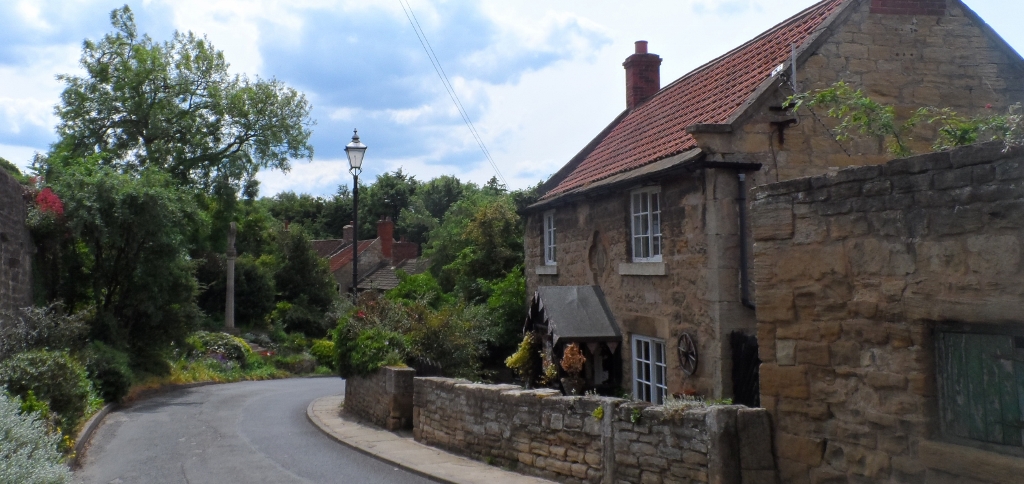
Although it was sunny, most of the village was in the shade and so I didn't take that many photographs of this beautiful photogenic hilltop village...although I was happy with most of them and so have included them.


I sat in the churchyard to eat my sandwiches - the ringing of the chimes here is quicker than anywhere else I know.

I left Hooton Pagnell walking to the south and passed through Watchley Crags until I reached Stotfold; just a farm complex really, and then climbed up the fairly steep hill to the top of Phoenix Park.


The parish church at Goldthorpe has an unusual Italianate design.


I got down onto the old railway cutting that goes to Barnburgh and got there a few minutes later. Barnburgh Church is associated with the Cat and Man Legend.


I walked down the hill to the Crown Inn, turned right and then took a footpath leading to the road which goes further down the hill to Denaby Ings. I didn't enter the nature reserve but continued over the bridge and along the bank of the River Dearne and then the course of the old railway line to Conisbrough.

The current Doncaster to Sheffield line still serves Conisbrough: there are no photographs of the church or castle at Conisbrough because as I passed by the station a train was due and so I caught it...and so didn't climb up the hill to the town centre.


Saturday, June 3, 2017

Thurnscoe, Clayton, Frickley, Hooton Pagnell, Bilham Row, Broodsworth, Pickburn, and Woodlands

I started today's walk after first having visited my parents at Thurnscoe, about eight miles from my home. My mum's not well, she's got terminal cancer, and I'm needing to spend a lot more time with them both.

Thurnscoe is a decent place to start a walk from though, it's situated at the foot of the Yorkshire Magnesian Limestone Ridge and there's some lovely countryside and very pretty villages nearby, 

My parents' home is quite near to the church and so that was the first thing I took a photograph of today. The church isn't really very old, most of it is an eighteenth century re-build. 


I then walked through the estate and across the fields to Clayton, where I ate my sandwiches sitting on a bench at the Millennium Green across from the village pond.


I turned down the lane leading to Teapot Corner and then took the track to the few houses at Frickley, and then Frickley Park. As I was walking along a stretch of one of the estate roads I arrived at a massive steel gate that was closed, and could only be opened by residents of the hamlet by using a keypad. It wasn't a problem for me to get by, I just stepped over a low wall at the side. As long as I've been alive this has always been a public right of way for both pedestrians and vehicular traffic and I'm not happy about this development. Technically there is an alternative route through a small wood, but this is a long detour...and certainly is no use to anyone in a car...or a delivery van.


At times it was difficult to find the path as a walked up the hill to Hooton Pagnell, one of my favourite villages anywhere. There are so many beautiful cottages in this limestone estate village; it wasn't quite looking its best today in the quite cloudy conditions. I'm sure everything will be ready for the annual Summer Fete in five weeks' time though - I'll be there again if the weather's fine.


I then took a route down to Brodsworth which was new to me, first arriving at Bilhan Row. I continued along the road to Pickburn and then over the footbridge over the motorway to reach Brodsworth Community Woodland and then finally the shops at Woodland where I waited for a bus back to Doncaster.