The weather forecast for today was for it to be dry until one o'clock...and it was accurate almost to the minute. After needing to make my regular Friday morning phone call I didn't want to be wasting any more time waiting for a bus and then just sitting down travelling to my destination, and so I started the walk today from my front door.
I walked into the town centre and then over North Bridge to Bentley. After waiting for seven minutes for four trains to pass at the two adjacent level crossings on the road going out towards Bentley Common I was stopped by a security guard and informed that further along the footpath is closed due to demolition work. So I had to turn back, this time experiencing no delay at either crossing though.
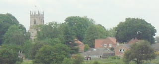
I went up the road to Bentley and then continued to Arksey, crossing over the railway without having to wait. Several dozen cyclists were gathering at the tearooms across from the church for the start of a road race.
By now I'd been walking for nearly an hour and a half when I found my first footpath, going alongside the road to Almholme, well hidden behind a hedge.
There are some attractive ruined farm buildings at Almholme.
I couldn't find the next footpath at Almholme - it looked like a large ranch-style bungalow has recently been built and blocked the route...so I had to take the lane heading south which eventually loops round to the Barnby Dun road.
I think this trelliswork structure used to carry a pipeline taking ash to be deposited onto the spoilheap at the old Thorpe Marsh Power Station.
Maybe the methane produced by these cows could help produce some electricity to add to the national grid.
It was then another stretch of road until I reached Barnby Dun.
I then walked across the fields and along the road to South Bramwith. It was one o'clock when I was approaching the village and it started to rain...precisely as forecast! So, I made my way to the bus stop at Stainforth by the shortest route; I got slightly lost though and so it wasn't the shortest route.
When I'd got on the bus and wanted to check how far I'd walked I unzipped my cagoule and pulled out my mapcase which had been hanging round my neck...but the map wasn't inside the case: I must not have squeezed the velcro fastening tight enough to prevent it from slipping out and escaping.
UPDATE: I've been informed that the pipeline was used to take waste from Pilkington's glassworks to the settling ponds in the area I was walking...nothing at all to do with the former power station.
UPDATE: I've been informed that the pipeline was used to take waste from Pilkington's glassworks to the settling ponds in the area I was walking...nothing at all to do with the former power station.


No comments:
Post a Comment