Showing posts with label Hay Dale. Show all posts

Sunday, April 2, 2017

Tideswell, Sparrowpit, And Castleton.

The bus journey to Tideswell from Sheffield started off by me helping a young Chinese woman, most likely a student, work out where she wanted to get off the bus. She just kept repeating the words 'Monsal Trail' and showing the driver her mobile phone. In the end the driver, myself, and another driver who was walking by worked out that she was wanting to go to Miller's Dale, the only place where she could easily reach the trail from anywhere along the bus route. 

I arrived at Tideswell, and without looking at the map, headed out of the village in a westerly direction hoping to soon come to a footpath which would take me towards Peter Dale. Maybe this was a mistake because I needed to walk along a road for more than a mile until I reached the entrance to the dale. I don't like having to frequently stop to consult my map...it spoils the walk for me. This would become even more evident later on when I got lost by just heading off in the general direction I needed to be going and somehow straying from a footpath which looked to be quite straight, and straightforward,  on the map.

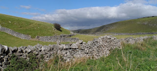
There were some expansive panoramic views of the White Peak countryside from this stretch of road though.


It's a pleasant, and quite easy walk up Peter Dale and then Hay Dale, although I left the latter half way up to continue following the Pennine Bridleway along a well maintained track, then a short stretch of road until I reached the next footpath. There was then another short stretch of road...and then my problems began. I consulted the map, was confident that I'd memorised the route for the next mile or so until I'd reach the main A623 road. The path appeared to go pretty much in a straight line, and that's what I did - I could see where I was going and so just headed off in that direction. In one instance there was a well-defined path...and then a few yards later an open gate which I walked through without checking the map...then, a few minutes later a dry stone wall and no way out of the field. I retraced my footsteps and soon found another gate which was closed, but I only needed to lift the latch...so I assumed this must be the route of the footpath. Wrong again; more walls, fences and locked gates which I had to negotiate until I reached the road. I've just been studying the map again and I still can't work out where I went wrong...a bit of signage along the way would have helped here...as it would a bit later on past Sparrowpit when I attempted to climb over an old dilapidated gate and it broke, leaving me with a prominent bruise on my inner thigh to add to my recent collection.

I always walk briskly when I'm walking along busy roads so it wasn't long until I reached Sparrowpit. Most of the village was up a hill where I didn't need to go...but I did pass by the pub - and it's got a very unusual name, The Wanted.


After struggling to find the path again and having to forge my own route across open country I eventually reached Rushup Edge. The walk along this ridge was the highlight of the day as I enjoyed the views of the Vale of Edale and The Great Ridge - with the sun being at the perfect angle for photography.


As I approached Mam Tor I was aware that time was tight if I wanted to catch the next bus from Castleton and so consciously increased my pace, even breaking into a jog when I reached a tarmacked surface. I arrived at the bus station with about five minutes to spare; I think I must have jogged for about a mile [yes, mainly gently downhill] but I didn't feel tired, out of breath, or even that sweaty...my health and fitness is still improving and I'm getting younger by the day. I've discovered the fountain of eternal youth...I just need to invent a time machine now and maybe I'll be able to go back and put things right in my life.

Wednesday, October 5, 2016

Tideswell To Bradwell

Because of some poorly laid out roadworks at Fox House the bus arrived at Tideswell nearly ten minutes late. After going to the toilets [which were immaculately clean] I made my way to the southern end of the village where I located the footpath I would be using. 

I took a few photographs.


The last of these three photographs was taken as I was looking back at the village after having climbed over a stile when I was walking across the fields. It shows the council houses in the foreground; each of the larger villages in the Peak District has a similar estate, usually hidden away on the edge of the village.

After alternating sections of walking along well-maintained grass lanes and then across more fields I arrived at the road which tumbles down in to the entrance to Peter Dale.


Peter Dale can be a bit difficult underfoot along certain stretches and walking along here was the most challenging part of the walk; at times I had to concentrate hard and watch where I was putting every step.

Next up was Hay Dale; you could jog along most of this dale; it's grassy and a very even surface, I then took the steep track which leads uphill towards a minor road which I walked along until I reached the junction with the A623 trunk road.

As I'd expected, there were some lovely views of the White Peak countryside.


I then followed the route of the Limestone Way for a few minutes and then turned to the east across the fields and along the road to arrive at Bradwell Moor; a featureless grassy expanse with lots of old mineshafts. Although the land isn't fenced off it's not Access Land; for your safety you do need to stick to the footpaths.

I walked along a short stretch of road, marked as 'Batham Gate', a Roman road, on the map, and then made my way down to Bradwell. By the time I reached the bus stop the bus to Sheffield had already departed, but I didn't have to wait long for the 'school bus,' an extra service laid on at this time during term time for the school children. It only goes to Hathersage though, but there's more to do in Hathersage than there is at Bradwell...and I only had twenty minutes to kill until the Sheffield bus showed up.

I had a couple of quite long conversations today; with a man out walking his dog near Tideswell, a local man who has recently moved up from London, and then later down in Peter Dale when I got talking to a fellow hiker. When this happens it's the icing on the cake for me, a bit of human interaction makes a day out walking much more pleasurable.

I'm very lonely and socially isolated, I've never had a job or a relationship, and I don't have much family around or have many friends: most people probably go walking in the Peak District to escape from their busy and stressful lives for a few hours...I go there seeking companionship, challenge, and stimulation.

Sunday, January 15, 2012

Miller's Dale, Peak Forest, Old Dam and Castleton.

Although the train for Sheffield was powered up and ready to leave, no passengers were allowed to board; it first had to be moved to another platform. To me this seems a rather stupid thing to do, since it's the first departure of the day and obviously not interfering with any other service, yet there must be some logical, easily-explained reason: maybe the Sheffield track couldn't be accessed from the original platform, or the signals and points had been pre-set overnight...I don't know.

Including Miller's dale, I visited six dales today; and walked the entire length of five of them. Monk's Dale starts at the hamlet of Miller's Dale, and is reached by taking the footpath right at the side of the chapel. There's a short climb before you descend into the wooded valley.


The photograph was taken at the top of the short climb; it's actually in colour, but the frost makes everything seem monochrome.

For the majority of this walk I was walking in the dale bottoms. Monk's Dale is mainly wooded and the path is strewn with moss-covered stones and fallen trees; if it weren't for the effects of the keen overnight frost some sections which were very boggy would have made very difficult walking conditions.

After nearly ninety minutes I reached the top of the dale, crossed the road and entered my third dale, Peter Dale, a much shallower and more open dale; and only just over half the length of Monk's Dale. I made fairly quick progress.

Next up was Hay Dale, itself shallower, more open and shorter than Peter Dale. The first two observations also apply to the next dale, Dam Dale, when comparing it to its predecessor - it is slightly longer than Hay Dale though.

After walking along valleys for nearly five miles I arrived at Peak Forest, crossed the main road and took the lane which leads to the hamlet of Old Dam; my first visit there.

Unusually, the toughest climb came towards the end of the walk - it wasn't that difficult though as I steadily climbed across the fields to reach the high limestone grasslands above Castleton and bagged my final dale of the day, Cave Dale; which was a difficult descent today due to the large amounts of water and the slippery rocks.

I had time in Castleton to enjoy some fish and chips this time. By the time I had eaten them the sun had set and it was getting rather cold. As I was sitting in the bus station waiting for the bus I began to shiver and feel a little uncomfortable; possibly because I'd been sweating a lot earlier and my clothes were now damp.

I broke open one of those chemical hand waters: it wasn't very effective though.