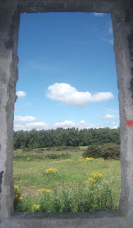
There's a large area of open land to the south of Rossington that's accessible to the public and this was the destination of my walk today. There are some industrial or military ruins there and yesterday I spent quite a bit of time online studying old maps to see if I could find out what they were, but nothing showed up.
I got there by walking to the Lakeside area and then continued along the Doncaster Greenway and the path that passes through Doncaster Golf Course and then crosses over the River Torne.
I spotted a squirrel on the fairway - maybe that's a new golfing term I've just learned.
I stopped to photograph the church at Rossington and then headed down a snicket towards some playing fields and then the area of open land. I visited this area on an earlier lockdown walk a few weeks ago and wanted to return to explore it further. I wandered along the various paths, passing through heath-like countryside, grassland meadows, woodland, and a duck pond...I also went back to photograph the ruins I'd noticed at the time. There are a lot of paths in the area and so I will be returning to explore more of them.
I reached as far as Rossington Hall, now operating as a country hotel, before I headed back home, returning on a more westerly route.
I walked through the village and continued to use a route that goes further west until I reached a point where I hoped I'd be able to take a short cut towards the pedestrian level crossing at Bessacarr. Now that I know where this path is, and where it goes to, it will be very useful for future local lockdown walks.
UPDATE: I've been informed that the derelict building I photographed is the loco shed for the narrow gauge railway that used to operate in the gravel quarry that was located there. Cheers Daniel!
UPDATE 2: I've now been informed that the smaller structures nearby are gun emplacements, as I thought they might be.


