I'm really struggling with the weather forecasts at the moment; using them to decide where and when to go for a walk. Today's forecast was for 'a bit of rain' in Bakewell in the Peak District this afternoon and 'occasional rain' for here in Doncaster. I'm not sure which would be worse though, a bit of rain or occasional rain. Whichever, I'm convinced that modern weather forecasts aren't as good or useful as they used to be in the 1970s, there's far too much superfluous information provided. Since the direction of any bad weather would be coming from the south west I assumed that it would reach the Peak District first...and so opted for a local walk. I stuck with this decision even when a few hours later the forecast had been updated to 'light showers.' As it turned out whatever phrase I preferred the forecast was very inaccurate, the rain arrived at least two hours early from a different direction, the southeast...and at times it was quite heavy with a bit of sleet.
I caught the Wakefield bus and got off at Upton and walked along the road that leads to Badsworth and then took the path that starts at the back of the water tower and goes across the fields, eventually to Badsworth.
The approach to Badsworth along a tarmac'd path which leads directly to the churchyard is lovely.
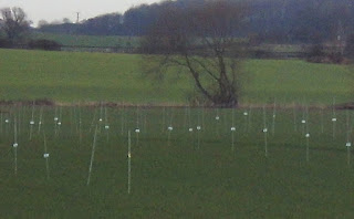
As I was walking along the bridleway heading towards East Hardwick I spotted something in a nearby field that I've not seen before - several hundred canes with something white attached to each one, neatly positioned in four or five straight lines, occupying only one specific area. I don't know what this is for.
The photograph isn't very good.
A few yards further on there was something else I hadn't seen before either - a gravestone for a road that's died.
The inscription reads, 'Here Ends Ackworth Bulls Road.'
This bridleway ended at the Doncaster road just south of East Hardwick, just before this lovely milestone: there five destinations to the north, the direction I was walking...but only Doncaster in the other direction behind me.
I ate my sandwiches in the churchyard at East Hardwick; the church is a rather plain and uninteresting Victorian building and so I didn't bother taking any photographs.
I took a muddy path across a field and then walked along a couple of different roads until I reached the footpath leading up onto Went Edge [or Went Hill.]
Although it's only about two hundred feet above sea level there are some good views from along here - it was very windy and exposed though today...especially since the rain, of whatever type, had started to fall.
As I crossed over the bridge at Wentbridge I stepped out into the middle of the road to take this photograph of the blue plaque giving details about Robin Hood.
There was a good view of the church in the distance as I entered Brockadale and followed the course of the River Went to Kirk Smeaton.
I'd had enough of the rain and the cold wind when I reached Kirk Smeaton and so I walked down the road to Norton, getting there as quickly as I could; I had about fifteen minutes to wait for the bus back to Doncaster.


No comments:
Post a Comment